
مقدمة
تقع بيج، أريزونا، على بعد حوالي 280 ميلاً من فينيكس - رحلة قيادة تستغرق ما بين 4.5 إلى 5 ساعات باتجاه الشمال عبر الطريق السريع I-17 والطريق US-89، مروراً بفليموونت وكليمونت كلايفز. ومعالم مثل وادي أنتلوب، وهورس شو بيند، وبحيرة باول تجعل هذه الرحلة تستحق العناء؛ إليك ما تتطلبه الرحلة ومتى تكون خدمة النقل من الباب إلى الباب بأسعار ثابتة خياراً أفضل من استئجار سيارة. هل تحتاج إلى رحلة على هذا المسار؟ احجز خدمة النقل من الباب إلى الباب من فينيكس إلى بيج بأسعار ثابتة وخدمة متاحة على مدار الساعة طوال أيام الأسبوع عبر هنا.
لماذا تزور بيج، أريزونا؟
تُعرف Page, Arizona، على نطاق واسع بأنها البوابة إلى بعض من أجمل المعالم الطبيعية في United States. Antelope Canyon وHorseshoe Bend وLake Powell وGlen Canyon Dam ليست سوى عدد قليل من المشاهد الخلابة التي تجذب السياح من أنحاء العالم. ولخيار أخفّ على البال، اطّلع على خدمة النقل من Sedona إلى Phoenix لدينا، حيث أسعار ثابتة معلنة مسبقًا واستلام من الباب إلى الباب.
يجمع كثير من المسافرين بين محطات شمال Arizona في جدول رحلة واحد، وإذا كانت الصخور الحمراء في Sedona ضمن قائمة وجهاتك، فإن خدمة النقل من Phoenix إلى Sedona تقطع المسار الذي يبلغ 116 ميلًا في نحو ساعتين، مع خدمة من الباب إلى الباب.
Antelope Canyon
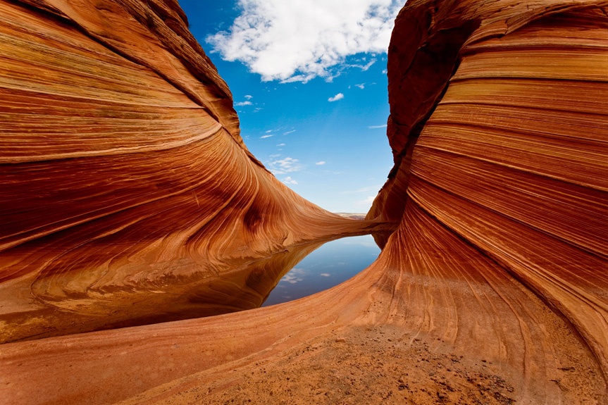
يُعد Antelope Canyon بلا شك أبرز معالم الجذب، إذ تشتهر تكويناته الصخرية الساحرة التي نحتها قرون من التعرية بفعل الرياح والمياه. ويتألف من منطقتين متميزتين:
-
Lower Antelope Canyon: يُوصى به بشدة لكون جولاته أقل ازدحامًا وأسعاره معقولة، إلى جانب فرص تصوير خلابة لا تقل جمالًا.
-
Upper Antelope Canyon: شائع، لكنه غالبًا ما يكون مزدحمًا ويعتبره كثير من المسافرين مرتفع الثمن بشكل مبالغ فيه، وينصحون بأن Lower Canyon يقدم قيمة وتجربة أفضل.
معالم أخرى بالقرب من Page
-
هورشوي بيند: تقدم إطلالات بانورامية تخطف الأنفاس على نهر كولورادو.
-
بحيرة بول: مثالية للتجذيل بالقارب، والسباحة، والصيد، والمشي لمسافات طويلة.
-
سد غلين كانيون: يتيح فرصة لفهم تاريخ الهندسة بصورة مثيرة للاهتمام، إلى جانب إطلالات تخطف الأنفاس.
مسافة الرحلة والمدة الزمنية
تبلغ المسافة بين فينيكس، أريزونا، وباج، أريزونا، نحو ٢٨٠ ميلًا، وعادةً ما تستغرق الرحلة حوالي ٤٫٥ إلى ٥ ساعات بالسيارة أو بخدمات النقل بالترانسفر. وقد تختلف أوقات السفر حسب وسيلة النقل التي تختارها.
خيارات النقل من فينيكس إلى باج
يساعدك فهم خيارات النقل المتاحة على تبسيط خطط رحلتك كثيرًا: طرق النقل في فينيكس
١. خدمات النقل بالترانسفر (الخيار الأكثر توصية)
لماذا تختار خدمة النقل بالترانسفر؟
-
التوفر: حاليًا، تُعد خدمتنا للنقل بالترانسفر الخدمة الوحيدة التي توفر رحلات مباشرة من فينيكس إلى باج في ولاية أريزونا.
-
الراحة: خدمة من الباب إلى الباب، تعمل على مدار الساعة طوال أيام الأسبوع، مما يتيح للمسافرين مرونة أكبر عند تحديد المواعيد.
-
الراحة: مركبات فاخرة دون رسوم إضافية.
-
اقتصادي من حيث التكلفة: أسعارها تنافس أسعار Uber وLyft من دون خطر ارتفاع الأسعار أو مشكلات التوفر.
-
وفير للوقت: رحلات دون توقف تستغرق وقتًا مماثلًا لوقت القيادة الخاص بك (~4.5 ساعات).
كيف تعمل خدمة النقل المشترك لدينا:
-
استلام وتسليم من الباب إلى الباب: نستلمك ونوصلك عند أي عنوان في أريزونا.
-
خصومات الرحلات ذهابًا وإيابًا: وفّر حوالي 10% على حجوزات الرحلات ذهابًا وإيابًا.
-
توقفات مخصصة: ورغم أنها تكون عادةً دون توقف، يستطيع السائقون استيعاب التوقفات المطلوبة.
2. خدمات مشاركة الرحلات (Uber/Lyft)
على الرغم من أن Uber وLyft يغطيان هذا المسار نظريًا، نادرًا ما يقبل السائقون رحلات طويلة كهذه. والسبب اقتصادي بحت: السائقون لا يريدون كلفة العودة الفارغة إلى فينيكس وما يصاحب ذلك من إزعاج.
3. خدمات سيارات الأجرة
ورغم أن سيارات الأجرة تقدم نظريًا خدمة النقل من فينيكس إلى بايج، فقد تصل التكاليف إلى حدّ يصعب تحمّله:
-
التكلفة:أسعار سيارات الأجرة عادةً ما تكون ضعف أو ثلاثة أضعاف تكلفة خدمات النقل المشترك.
-
جودة المركبات:نادرًا ما تساوي سيارات الأجرة العادية راحة الحافلات الفاخرة.
4. غرايهاوند أو أريزونا شاتل
هذه الخدمات غير متاحة للرحلات من فينيكس إلى باج، AZ. فلا تخدم غرايهاوند باج، AZ، ولا تخدم أريزونا شاتل.
5. السيارات المستأجرة
يُنظر كثير من المسافرين في بداية الأمر إلى السيارات المستأجرة، لكنهم كثيرًا ما يستهينون بالتكاليف الحقيقية:
-
رسوم الإرجاع:غالبًا ما تفرض على السيارات المستأجرة التي تُرجع في باج رسوم $150-$250.
-
المصاريف المخفية:تؤدي التأمينات والبنزين والضرائب والأيام الإضافية إلى ارتفاع التكلفة بسرعة.
-
إزعاج المطار:استلام أو إرجاع السيارات المستأجرة من مطار فينيكس قد يكون معقدًا ويستغرق وقتًا طويلًا.
لماذا تُعد خدمات النقل المشترك أفضل خيار
بالنظر إلى هذه الخيارات، تبرز خدمات النقل المشترك بوضوح كحل نقل مثالي من فينيكس إلى باج، AZ:
-
جدولة موثوقة:توافر مضمون حسب راحتك.
-
تجربة فاخرة:ركوب مريح في مركبات فاخرة من دون تكاليف إضافية.
-
الشفافية في الأسعار:لا رسوم خفية ولا رسوم إضافية مفاجئة.
-
توفير الوقت:يساعد التنقل المباشر دون توقف على الوصول في الوقت المحدد، وهو أمر بالغ الأهمية للجولات السياحية والفعاليات ذات المواعيد المحددة.
استكشاف بايج، أريزونا
بعد وصولك إلى بايج، ستتاح لك فرص واسعة لاستكشاف عجايب طبيعية وتجارب لا تُنسى:
هل تنوي السفر إلى جهة أبعد في المنطقة؟ نقدم أيضًا خدمة النقل من بايج إلى فينيكس.
كانيو الأنترليو السفلي
اختَر جولات كانيو الأنترليو السفلي، إذ تتميز بتجربة تستحق قيمتها، ومناظرها الخلابة، وقلّة الازدحام فيها. وهذا يمنح المصورين والسياح على حد سواء تجربة أكثر هدوءًا وأصالة.
هورسشوي بند
تُعدّ هورسشوي بند، الواقعة على بُعد قصير من بايج، واحدة من أشهر المناظر لنهر كولورادو. وتتيح نقطة المشاهدة فرصًا مذهلة للتصوير، ولا سيما وقت غروب الشمس.
بحيرة بول
تتيح بحيرة باول فرصًا واسعة للتسلية، مثل ركوب القوارب، وركوب الكاياك، والسباحة، والصيد. ويشتهر هذا الخزان الشاسع بمياهه الصافية ومناظره الخلابة وخليجيه الهادئين، المثاليين للاسترخاء.
سد غلين كانيون
يُعد سد غلين كانيون إنجازًا هندسيًا استثنائيًا، ويمنح الزوار مناظر بانورامية للسد والمناظر الطبيعية المحيطة به. وتوفر جولات الزيارة فرصة لاستكشاف تفاصيل مثيرة حول كيفية بناء السد وكيف يعمل.
نصائح السفر من فينيكس إلى بايج، AZ
-
الحجز مسبقًا:احجز خدمة النقل مبكرًا لضمان توفرها، ولا سيما خلال مواسم الذروة السياحية.
-
جهّز حقيبة رحلتك:يمكن أن يكون مناخ أريزونا قاسيًا جدًا، لذلك غلّغ ما يناسب ذلك، مع كمية وفيرة من الماء، وواقي الشمس، وملابس مناسبة.
-
التواصل:انتبه إلى أن تغطية الهاتف قد تكون محدودة في أجزاء من رحلتك، ولا سيما في المناطق الصحراوية النائية.
قسم الأسئلة الشائعة
هل يمكن حجز وسيلة نقل في آخر لحظة؟
نعم، لكن يُفضّل الحجز مسبقًا لضمان التوفر وتسهيل جدولة الرحلة.
كيف تقارن أسعار خدمات النقل بأسعار أوبر وليفت؟
تطابق أسعار خدمات النقل بالمطلب لدينا الأسعار المعتادة للرحلات الطويلة لدى Uber وLyft، مع ضمان الخدمة ومن دون أسعار متغيرة.
هل مسموح بالتوقف أثناء رحلة النقل بالمطلب؟
ورغم أن الرحلات تكون عادةً دون توقف، يستجيب السائقون بترحاب لطلبات التوقف للراحة أو للاستمتاع بالمناظر عند الحاجة.
ما نوع المركبات التي تستخدمها خدمة النقل بالمطلب؟
يشمل أسطولنا علامات تجارية فاخرة مثل Mercedes وLexus وLincoln وChrysler، بما يضمن الراحة طوال رحلتكم.
الخاتمة
ليس من الضروري أن تكون الرحلة من Phoenix إلى Page, AZ معقّدة أو مرهقة. فاختيار وسيلة النقل المناسبة يعزّز بشكل كبير تجربة سفرك، مما يجعل رحلتك مريحة وفي الوقت المحدد وممتعة. تقدّم خدمتنا للنقل بالمطلب أفضل حل، إذ توصلك بسلاسة إلى مناظر Arizona الطبيعية الخلابة ومعالمها السياحية، من دون رسوم خفية ولا متاعب استئجار السيارات أو سيارات الأجرة.
احجز رحلتك اليوم واستمتع برحلة فاخرة وفعّالة وخالية من المتاعب من Phoenix إلى Page, AZ، مع استكشاف Antelope Canyon ومعالم مدهشة أخرى.
الأسئلة الشائعة
ما أبرز المعالم السياحية في Page التي لا ينبغي أن تفوّت؟
تشتهر Page بـAntelope Canyon وHorseshoe Bend وLake Powell وGlen Canyon Dam.
كم تستغرق الرحلة بالسيارة من Phoenix إلى Page؟
تستغرق الرحلة عادةً حوالي ٤٫٥ ساعات بالسيارة أو بحافلة نقل مشترك.
أي وادٍ في بايج أقل ازدحامًا وأكثر ملاءمة من حيث السعر للتجولات السياحية؟
يُنصح بوادي أنطيلوبو السفلي نظرًا لأن جولاته أقل ازدحامًا وأسعاره معقولة. هل تحتاج إلى خدمة نقل مشترك في هذه المنطقة؟ تعرض صفحتنا خدمة النقل من فلاغستاف إلى بايج أسعارًا ثابتة وإمكانية الحجز عبر الإنترنت.
ما مزايا استخدام خدمة نقل مشترك من فينيكس إلى بايج؟
توفر خدمات النقل المشترك رحلات مباشرة، وتعمل على مدار الساعة طوال أيام الأسبوع، وتسهل الوصول من الباب إلى الباب، وتضم مركبات فاخرة، وتقدم أسعارًا تنافسية. هل تخطط لمسار آخر؟ تصفح صفحتنا خدمة النقل في أريزونا إلى بايج لمعرفة الأسعار الثابتة والحجز عبر الإنترنت.
رحلة الطريق إلى Page، مفصّلة
تتنقسم رحلة الـ~280 ميلاً إلى نصفين مختلفين تماماً، ومعرفة أين تتغير طبيعة الطريق تساعدك على تحديد محطات الوقود والتوقف لتناول الطعام ووقفات الراحة:
| المرحلة | الطريق السريع | المسافة | وقت القيادة |
|---|---|---|---|
| فينيكس إلى فلاغستاف | I-17 | حوالي 145 ميلًا | حوالي ساعتين و15 دقيقة |
| فلاغستاف إلى بايج | US-89 | حوالي 135 ميلًا | حوالي ساعتين و15 دقيقة |
| المجموع من فينيكس إلى بايج | I-17 + US-89 | حوالي 280 ميلًا | حوالي 4 ساعات و30 دقيقة |
تبدأ المرحلة الأولى بصعود نحو ميل في الارتفاع من الصحراء إلى غابات الصنوبر المحيطة بفلاغستاف؛ أما المرحلة الثانية فتقطع هضبة الصحراء العالية مرورًا بكاميرون قبل أن تهبط نحو نهر كولورادو في بايج.
الطقس والازدحام على الطريق I-17 شمال فينيكس - لا المسافة - هما أكثر ما يطيلان الرحلة لتتجاوز أربع ساعات ونصف.كم تكلف شافلة خاصة للوصول إلى Page فعليًا؟
تبعد Page عن فينيكس بما يكفي بحيث لا تكون أسعار تذكرة المشاركة للشخص الواحد أمرًا فعليًا متاحًا - فهذا ممر للمركبات الخاصة. فيما يلي ما تشير إليه صفحة الدفع لدينا حاليًا لمسار Phoenix Sky Harbor إلى Page، حسب فئة المركبة:
| المركبة | السعة | الأجرة الحالية |
|---|---|---|
| سيدان رباعية الأبواب | من 1 إلى 2 من الركاب | $674.59 |
| سيارة دفع رباعي كبيرة | حتى 4 من الركاب | $861.67 |
| حافلة نقل جماعي | 8+ من الركاب | $1,610.31 |
هذه أسعار للمركبة كاملة، لذا سيدفع مجموعة تضم أربعة أشخاص في سيارة دفع رباعي كبيرة نحو $215 للفرد من الباب إلى الباب، وهو ما يقارب ما ينفقه كثير من المسافرين على ليلة إقامة واحدة في Page خلال موسم الذروة. تُعرض الأسعار مباشرة وقت الحجز، والأرقام أعلاه هي أسعار الدفع الحالية وليست تقديرات.
دلائل طرق أخرى للمناطق المرتفعة
- كم تبعد Flagstaff عن Phoenix؟ - تفاصيل النصف الأول من هذه الرحلة
- خدمة النقل من Phoenix إلى Payson
- خدمة النقل من Phoenix إلى Kingman
- أقرب مطار إلى Sedona, AZ
كم تبعد Page, Arizona عن Phoenix؟ الإجابة السريعة
تقع Page تقريبًا على بعد 275–280 ميلًا شمال Phoenix — أي نحو 443 كيلومترًا — وتستغرق الرحلة بالسيارة من 4.5 إلى 5 ساعات في الظروف العادية. تقيس أدوات تخطيط الرحلات مثل travelmath.com وhow-far.net المسافة بـ278 ميلًا، مع وقت قيادة يقارب 4 ساعات و49 دقيقة. ومع إضافة توقف للوقود أو الطعام، سيكون الوقت الواقعي للرحلة ذهابًا واحدًا قريبًا من خمس ساعات.
طريق القيادة: ما الطرق السريعة التي تأخذك إلى هناك؟
يتّبع تقريبًا جميع المسافرين المسار نفسه: طريق بين الولايات ١٧ متجهًا شمالًا خارج فينيكس، ثم جزءًا قصيرًا من طريق بين الولايات ٤٠ قرب فلاغستاف، وبعدها الطريق السريع الأمريكي ٨٩ شمالًا إلى بايج.
فينيكس إلى فلاغستاف عبر طريق بين الولايات ١٧
من وسط مدينة فينيكس، ستمرّ بأنفاق ديك بارك على طريق بين الولايات ١٠ قبل أن تلتحق بطريق بين الولايات ١٧ شمالًا — حيث تظهر لافتاته أولًا باسم طريق بلاك كانيون السريعي، ثم يواصل الطريق مسافة نحو ٧٨ ميلًا باسم طريق محاربين أريزونا الوطنيين. يرتفع الطريق تدريجيًا عند خروجه من صحراء سونورا، مرورًا بمدينة بلاك كانيون وكامب فيردي، قبل الوصول إلى فلاغستاف على ارتفاع يقارب ٧٬٠٠٠ قدم.
فلاغستاف إلى بايج عبر الطريق السريع الأمريكي ٨٩
في فلاغستاف، التحق بطريق بين الولايات ٤٠ (طريق القلب الأرجواني) واستمرّ فيه نحو ٥ أميال، ثم خذ مخرج الطريق السريع الأمريكي ٨٩ شمالًا. يعدّي الطريق حقل سان فرانسيسكو البركاني أسفل قمم سان فرانسيسكو، وينزل عبر خندق نهر كولورادو الصغير عند كامرون، ثم يتجه عبر أراضٍ تتبع أمة النافاجو قبل هبوط دراماتيكي تظهر خلاله بحيرة باول لأول مرة. وينتهي المسار عند بوولفار جنوب بحيرة باول، على بعد دقائق من سد غلين كانيون ومكاتب جولات كهف الأنتيلوب.
الوصول إلى بايج: مقارنة خياراتك
للإجابة مباشرةً: القيادة بنفسك هي أسرع خيار؛ أما النقل المشترك من باب إلى باب فهو الأنسب إذا كنت تفضّل عدم التعامل مع الطريق. وها هي مقارنة مباشرة بينهما:
| الخيار | الوقت المعتاد | الأنسب لـ | معلومات مهمة |
|---|---|---|---|
| القيادة بسيارتك أو سيارة مستأجرة | حوالي 4.5–5 ساعات | المرونة والتوقفات السياحية | الخيار الأكثر مرونة؛ خصّصوا ميزانية للوقود ذهابًا وإيابًا على طريق مسافته 278 ميلًا |
| نقل خاص | حوالي 5–6 ساعات من الباب إلى الباب | الأشخاص الذين لا يسوقون، والعائلات، والمصورين | استلام من أي عنوان في Arizona؛ من دون عناء البحث عن موقف أو التعامل مع الملاحة |
| Uber/Lyft | نظريًا فقط | غير عملي | نادرًا ما يقبل السائقون هذه الرحلة لأن رحلة العودة ستكون فارغة |
| تاكسي | حوالي 5 ساعات | الحالات الطارئة | تجعل أسعار العداد للمسافات الطويلة هذا الخيار الأرضي الأغلى |
| القطار إلى Flagstaff ثم استئجار سيارة أو حافلة | من 2 إلى 3 ساعات من Flagstaff | مسافو القطار | لا تتوفر خدمة قطار في Page؛ ستظلون بحاجة إلى وسيلة نقل للرحلة الأخيرة |
| رحلة جوية خاصة | حوالي ساعة واحدة في الجو | مسافرون يعانون من ضيق الوقت | سريعة لكنها مكلفة؛ لا تتوفر إلا كرحلات جوية خاصة |
ما المبلغ الذي ينبغي أن تخصصوه؟ (تقديرات، وليست عروض أسعار)
تتغير الأرقام الدقيقة وفقًا لأسعار الوقود، لذلك تعامل أي رقم على أنه تقدير. توقّع التزود بالوقود مرة واحدة على الأقل في كل اتجاه — إذ سترتفع أكثر من 3,000 قدم من فينيكس (نحو 1,086 قدمًا فوق مستوى سطح البحر، وفقًا لموقع how-far.net) إلى بيج (4,118 قدمًا)، والطلعات المطوّلة تستهلك وقودًا بمعدل أعلى من القيادة داخل المدن. تساعد مشاركة السيارة على تقسيم تكاليف الوقود بين كل شخص، أما خدمة الشاتل بسعر ثابت فتزيل حسابات الوقود والتآكل ومواقف السيارات تمامًا، لأنك تحصل على عرض سعر مؤكد قبل الحجز.
الأسئلة الشائعة: من فينيكس إلى بيج، AZ
كم مسافة بيج، أريزونا من فينيكس؟
نحو 275–280 ميلًا (443 كم) في اتجاه واحد. وتُظهر معظم أدوات تحديد الطرق مسافة 278 ميلًا ووقت قيادة قدره 4 ساعات و49 دقيقة قبل التوقفات.
ما أسرع طريقة للوصول من فينيكس إلى بيج؟
بالسيارة. فرحلة من 4.5 إلى 5 ساعات عبر الطريق السريع I-17 وUS-89 أسرع من أي بديل آخر من حيث الوقت والمرونة.
هل توجد خدمة شاتل من فينيكس إلى بيج؟
نعم. تعمل خدمة الشاتل من الباب إلى الباب 24/7، وعادةً ما تكمل الرحلة في نحو 5–6 ساعات بما في ذلك الاستلام، sehingga يمكنك التخطيط لجولة وادي أنتيلوب بدلًا من الانشغال بالطريق.
هل يمكن الطيران من فينيكس إلى بيج؟
تعني السفر جواً استئجار طائرة خاصة يستغرق نحو ساعة واحدة تقريبًا — وهو أغلى بكثير من أي خيار بري، ويُفضّل تخصيصه للمسافرين الذين لا يتوفر لديهم وقت فعليًا.
هل يمكن السفر بالقطار من فينيكس إلى بيج؟
لا توجد في بايج خدمة قطار. والحل العملي هو ركوب القطار إلى Flagstaff، ثم استئجار سيارة أو ركوب حافلة متصلة أو خدمة نقل تكميلية لتغطية آخر ساعتين إلى ثلاث ساعات من الطريق شمالاً.
هل توجد محطّات تستحق التوقّف عليها على طول الطريق؟
نعم، كثيرة. يقع Sunset Point overlook مباشرة خارج I-17، ويمكن الانحراف بسهولة إلى Camp Verde، ويُعدّ وسط Flagstaff محطة جيدة لتناول الغداء، كما يُعدّ Cameron Trading Post على US-89 محطة كلاسيكية للراحة قبل آخر جزء من الطريق إلى Page.
