

परिचय
उचित योजना के साथ फीनिक्स से पायसन, एरिज़ोना की यात्रा एक सुखद और तनावमुक्त अनुभव हो सकती है। "एरिज़ोना का हृदय" के रूप में जाना जाने वाला पायसन मनोरम पहाड़ी दृश्य, हरे-भरे जंगल, आउटडोर मनोरंजक गतिविधियाँ और एक आकर्षक छोटे शहर का माहौल प्रदान करता है। चाहे आप परिवार से मिलने आएँ, सप्ताहांत की छुट्टी बिताने आएँ या एरिज़ोना की प्राकृतिक सुंदरता देखने आएँ, अपने परिवहन विकल्प जानना आपकी यात्रा को सहज बना देगा। फीनिक्स से पायसन शटल सेवा
इस यात्रा में कितना समय लगता है, लागत कितनी है, और कब फ्लैट-रेट शटल खुद गाड़ी चलाने से बेहतर रहता है — यही यहाँ बताया गया है।
पायसन, एरिज़ोना क्यों घूमें?
पायसन फीनिक्स से ठीक 90 मील उत्तर-पूर्व में बसा एक छिपा हुआ रत्न है। ठंडे तापमान — विशेष रूप से एरिज़ोना की गर्म गर्मियों में — के लिए जाना जाने वाला पायसन आउटडोर प्रेमियों, प्रकृति प्रेमियों और आराम व शांति चाहने वालों को अपनी ओर खींचता है।
पायसन के प्रमुख आकर्षण
-
टोंटो नैचुरल ब्रिज स्टेट पार्क: दुनिया के सबसे बड़े प्राकृतिक ट्रैवर्टाइन पुलों में से एक का घर। पायसन आकर्षण गाइड
-
मोगोयॉन रिम: विस्तृत पैनोरमिक दृश्य, हाइकिंग ट्रेल और शानदार फोटोग्राफी के अवसर प्रदान करता है।
-
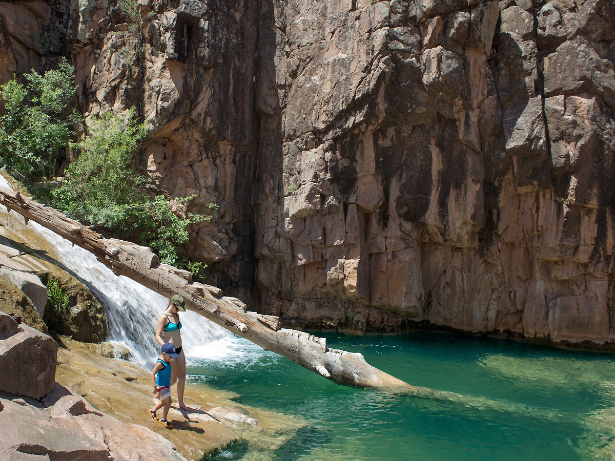
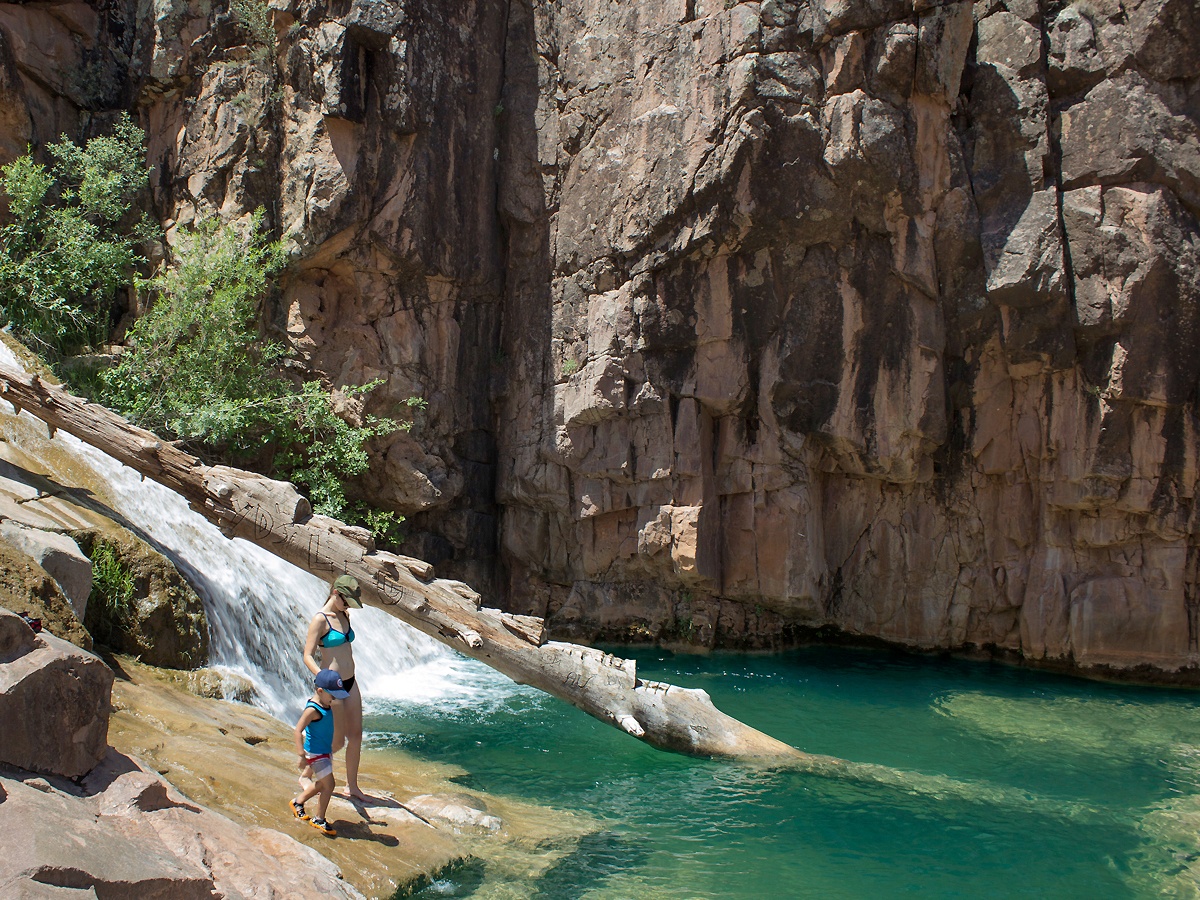
मछली पकड़ना और मनोरंजन: मछली पकड़ने, कायाकिंग और पिकनिक के लिए आदर्श अनेक झीलें और झरने।
-
स्थानीय त्योहार: पायसन में रोडियो, कला महोत्सव और प्रसिद्ध एरिज़ोना स्टेट चैंपियनशिप ओल्ड टाइम फिडलर्स प्रतियोगिता आयोजित होती है।
दूरी और यात्रा समय
फीनिक्स से पायसन की दूरी लगभग 90 मील है, और कार या शटल से यात्रा का समय औसतन लगभग 1. फीनिक्स से दूरी5 घंटे लगता है।
फीनिक्स से पायसन तक परिवहन विकल्प
सूचित निर्णय लेने के लिए आइए उपलब्ध परिवहन विकल्पों को देखें: परिवहन विकल्प समीक्षा
1. शटल सेवाएँ (अत्यधिक अनुशंसित)
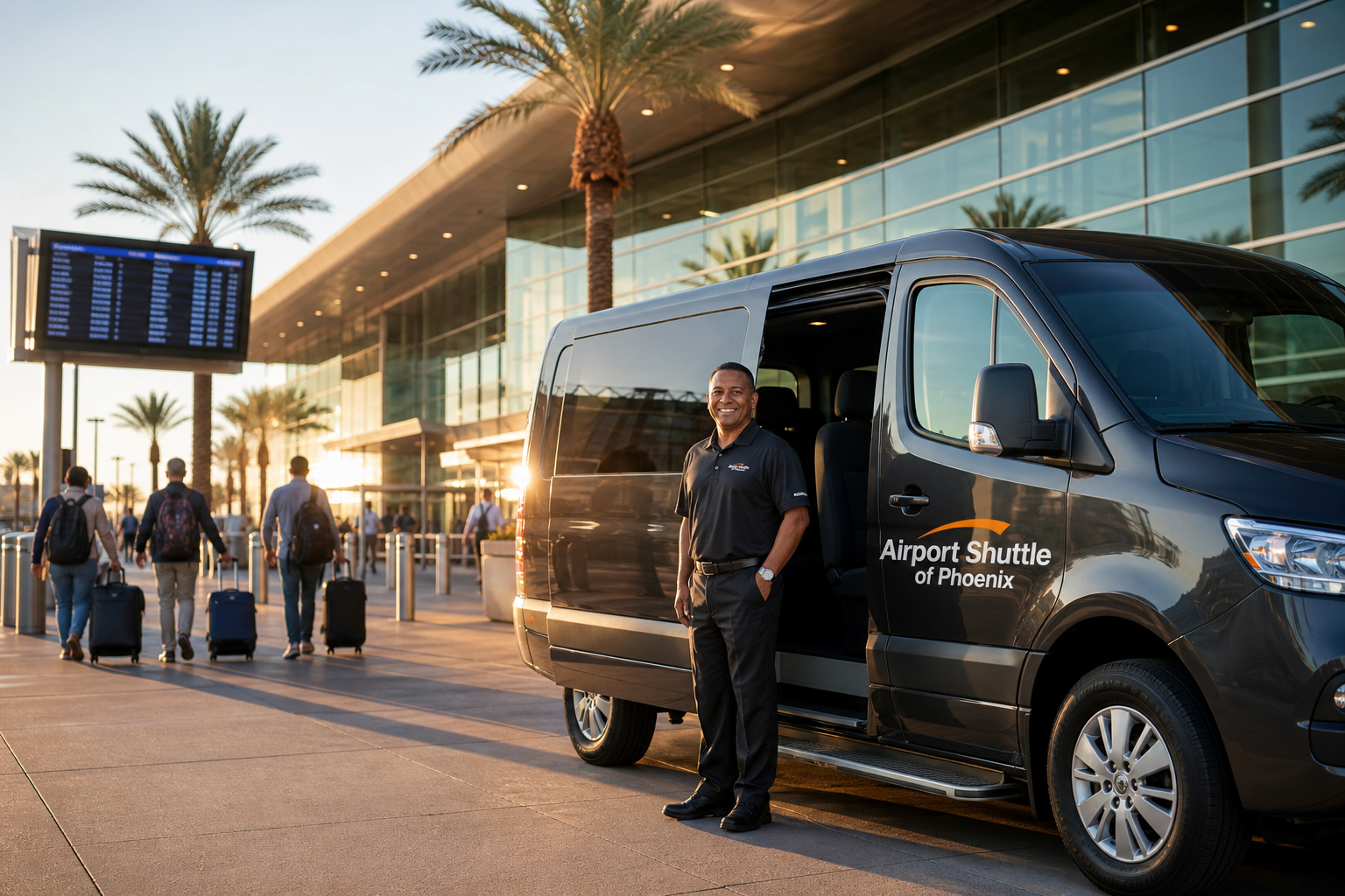
फीनिक्स से पायसन शटल सेवा कई कारणों से सर्वश्रेष्ठ परिवहन विकल्प के रूप में उभरती है:
-
डोर-टू-डोर सेवा: 24/7 संचालित, यात्रियों को अतुलनीय लचीलापन देती है।
-
विशेष उपलब्धता: वर्तमान में फीनिक्स और पायसन को सीधे जोड़ने वाली यह एकमात्र शटल सेवा है।
-
सुविधा: गारंटीकृत पिकअप और समय पर पहुँच — व्यावसायिक यात्रियों और पर्यटकों दोनों के लिए विशेष रूप से उपयोगी।
-
आराम और विलासिता: शटल में Lexus, Mercedes, Lincoln और Chrysler जैसी प्रीमियम गाड़ियाँ शामिल हैं, जो सुखद यात्रा अनुभव सुनिश्चित करती हैं।
लागत दक्षता: टैक्सियों से काफी सस्ती और Uber तथा Lyft के बराबर कीमत पर, बिना उनकी अप्रत्याशितता के।
बुकिंग सुझाव:
-
अग्रिम बुकिंग: कम से कम एक दिन पहले बुकिंग करने से उपलब्धता सुनिश्चित होती है और प्रतीक्षा से बचाव होता है।
-
राउंड-ट्रिप छूट: राउंड-ट्रिप यात्रा बुक करके लगभग 10% बचाएँ।
2. टैक्सी सेवाएँ
उपलब्ध होने के बावजूद, टैक्सियों के महत्वपूर्ण नुकसान हैं:
-
लागत: टैक्सी सेवाएँ अक्सर शटल सेवाओं से लगभग दोगुना शुल्क लेती हैं।
-
आराम: गाड़ियाँ आमतौर पर सामान्य स्तर की होती हैं, जिनमें शटल सेवाओं जैसी विलासिता नहीं होती।
3. राइडशेयर सेवाएँ (Uber और Lyft)
हालाँकि Uber और Lyft सैद्धांतिक रूप से उपलब्ध हैं, व्यावहारिक उपयोग में महत्वपूर्ण चुनौतियाँ आती हैं:
-
ड्राइवर रद्दीकरण: फीनिक्स खाली लौटने की असुविधा के कारण ड्राइवर अक्सर गंतव्य जानकर सवारी रद्द कर देते हैं।
-
छिपी लागतें: बार-बार रद्दीकरण से अतिरिक्त शुल्क लगते हैं।
-
अविश्वसनीय सेवा: यात्रियों को अक्सर काफी देरी और रद्दीकरण का सामना करना पड़ता है।
4. किराए की गाड़ियाँ
शुरुआत में आकर्षक लगने के बावजूद, किराए की गाड़ी में छिपी चुनौतियाँ और लागतें होती हैं:
-
वन-वे शुल्क: रेंटल कंपनियाँ अलग-अलग ड्रॉप-ऑफ स्थानों के लिए $150 से $250 तक वसूलती हैं।
-
क्रेडिट कार्ड आवश्यकताएँ: रेंटल कंपनियाँ आमतौर पर डेबिट कार्ड स्वीकार नहीं करतीं या भारी जमा राशि माँगती हैं।
-
अतिरिक्त खर्च: ईंधन, बीमा, कर और कई दिनों के किराए के कारण लागतें तेजी से बढ़ती हैं।
5. सार्वजनिक परिवहन
फीनिक्स और पायसन के बीच वर्तमान में कोई सार्वजनिक परिवहन (Greyhound और Arizona Shuttle सहित) उपलब्ध नहीं है।
शटल सेवा चुनने के लाभ
इन विकल्पों को देखते हुए, शटल सेवाएँ स्पष्ट रूप से सर्वोत्तम परिवहन साधन के रूप में सामने आती हैं:
-
किफायती: छिपी लागतों या अतिरिक्त शुल्कों के बिना सस्ती दरें।
-
विश्वसनीय और समय पर: समय की पाबंदी सुनिश्चित करती है, जो निर्धारित बैठकों, कार्यक्रमों या कनेक्टिंग उड़ानों के लिए महत्वपूर्ण है।
-
विलासितापूर्ण आराम: प्रीमियम गाड़ियाँ आरामदायक यात्रा प्रदान करती हैं।
-
सुविधा: डोर-टू-डोर सेवा अतिरिक्त परिवहन व्यवस्था की ज़रूरत समाप्त कर देती है।
पायसन की खोज
पायसन पहुँचकर आपको घूमने और आनंद लेने के ढेरों अवसर मिलेंगे:
टोंटो नैचुरल ब्रिज स्टेट पार्क
सभी स्तरों के लिए उपयुक्त हाइकिंग ट्रेलों के ज़रिए इस अद्भुत भूवैज्ञानिक संरचना की प्राकृतिक सुंदरता का अन्वेषण करें।
मोगोयॉन रिम
इस शानदार पहाड़ी किनारे पर लुभावने दृश्य, हाइकिंग ट्रेल, कैंपिंग स्थल और पिकनिक क्षेत्रों का आनंद लें।
आउटडोर मनोरंजन
पायसन के आसपास अनेक झीलों और नदियों पर मछली पकड़ने, घुड़सवारी, कायाकिंग और पक्षी देखने जैसी आउटडोर गतिविधियों का आनंद लें।
स्थानीय आयोजन और संस्कृति
रोडियो, त्योहारों, कला दीर्घाओं और ऐतिहासिक स्थलों सहित पायसन की जीवंत स्थानीय संस्कृति में भाग लें।
सहज यात्रा के लिए सुझाव
-
पहले से योजना बनाएँ: सहज शेड्यूलिंग के लिए अपनी शटल बुकिंग जल्दी पक्की करें।
-
पैकिंग सुझाव: मौसम पर विचार करें — पायसन फीनिक्स से ठंडा है, इसलिए तदनुसार परतदार कपड़े और आउटडोर सामान पैक करें।
-
संचार: फीनिक्स और पायसन के बीच मोबाइल सेवा अलग-अलग हो सकती है; शटल पिकअप का विवरण पहले से पुष्टि करें।
अक्सर पूछे जाने वाले प्रश्न (FAQs)
क्या पहले से बुकिंग ज़रूरी है?
आखिरी समय में बुकिंग संभव है, लेकिन कम से कम एक दिन पहले बुकिंग करने से उपलब्धता और समय पर पिकअप सुनिश्चित होते हैं।
क्या शटल यात्रा के दौरान स्टॉप का अनुरोध कर सकते हैं?
आमतौर पर नॉन-स्टॉप शटल अनुरोध पर संक्षिप्त स्टॉप स्वीकार कर सकते हैं।
शटल सेवा में कौन सी गाड़ियाँ उपयोग होती हैं?
Lexus, Mercedes, Lincoln और Chrysler जैसे विलासिता ब्रांड अधिकतम आराम सुनिश्चित करते हैं।
क्या शटल Uber या Lyft की तुलना में किफायती है?
कीमत Uber या Lyft जैसी ही है, लेकिन बिना सर्ज प्राइसिंग, ड्राइवर रद्दीकरण या छिपे शुल्कों के।
निष्कर्ष
फीनिक्स से पायसन की यात्रा जटिल या तनावपूर्ण होने की ज़रूरत नहीं है। शटल सेवाएँ चुनने से किफायत, आराम और सुविधा का आदर्श संतुलन मिलता है, जो टैक्सियों, किराए की गाड़ियों और अविश्वसनीय राइडशेयर सेवाओं से बेहतर है। फीनिक्स से पायसन तक बिना परेशानी की, आरामदायक यात्रा का आनंद लें, यह जानकर कि आपने उपलब्ध सबसे सुरक्षित, सबसे विश्वसनीय और सबसे किफायती यात्रा विकल्प चुना है।
आज ही अपना शटल बुक करें और फीनिक्स से पायसन, AZ के बीच सीधी, डोर-टू-डोर परिवहन की अतुलनीय सरलता और विलासिता का अनुभव करें।
अक्सर पूछे जाने वाले प्रश्न
फीनिक्स से पायसन जाने में कितना समय लगता है?
कार या शटल से यात्रा में औसतन लगभग 1.5 घंटे लगते हैं।
क्या रास्ते में पायसन तक मनोरम दृश्य दिखते हैं?
हाँ, मोगोयॉन रिम के रास्ते आपको विस्तृत पैनोरमिक दृश्य और हरे-भरे जंगल दिखाई देंगे।
पायसन में आउटडोर गतिविधियों के लिए कौन से आकर्षण सबसे अच्छे हैं?
टोंटो नैचुरल ब्रिज स्टेट पार्क हाइकिंग ट्रेल प्रदान करता है, जबकि अनेक झीलें और झरने मछली पकड़ने और कायाकिंग के शानदार स्थान हैं।
फीनिक्स से पायसन शटल सेवा अन्य परिवहन विकल्पों से कैसे तुलना करती है?
यह गारंटीकृत पिकअप के साथ अधिक सुविधाजनक और टैक्सियों से सस्ती है, जिसमें Lexus और Mercedes जैसी प्रीमियम गाड़ियाँ मिलती हैं। कोई दूसरा रास्ता सोच रहे हैं? फ्लैट-रेट प्राइसिंग और ऑनलाइन बुकिंग के लिए हमारा पायसन से फीनिक्स शटल पेज देखें।
पायसन फीनिक्स से कितनी दूर है? संक्षिप्त उत्तर
सड़क मार्ग से पायसन फीनिक्स से 89 मील (143 किमी) दूर है — स्टेट रूट 87, यानी बीलाइन हाईवे, से उत्तर-पूर्व की ओर टोंटो नेशनल फॉरेस्ट होते हुए, और अधिकांश ड्राइवर नॉन-स्टॉप लगभग 1 घंटा 30 से 40 मिनट में पहुँच जाते हैं। सीधी रेखा में दोनों शहरों के बीच केवल 69 मील (111 किमी) की दूरी है, इसलिए घुमावदार सड़क मार्ग लगभग 1.3 गुना हवाई दूरी के बराबर है।
पायसन का सबसे तेज़ रास्ता बनाम सबसे सस्ता रास्ता
roadonmap.com जैसे रूट प्लानर आमतौर पर दो ड्राइविंग विकल्प सुझाते हैं:
| रास्ता | दूरी | ड्राइविंग समय | क्यों चुनें |
|---|---|---|---|
| AZ 87 बीलाइन हाईवे (सबसे तेज़) | 89 मील / 143 किमी | ~1 घंटा 40 मिनट | सबसे सीधा; मानक रास्ता |
| वैकल्पिक रास्ता (सबसे धीमा) | 87 मील / 140 किमी | ~1 घंटा 45 मिनट | थोड़ा छोटा और ईंधन में थोड़ा सस्ता |
| सीधी रेखा (हवाई) | 69 मील / 111 किमी | ~21 मिनट की उड़ान | केवल संदर्भ हेतु — कोई नियमित सेवा नहीं |
ड्राइविंग निर्देश: AZ 87 होते हुए फीनिक्स से पायसन
- फीनिक्स के डाउनटाउन से ईस्ट वैन ब्यूरेन स्ट्रीट पर पूर्व की ओर चलें।
- I-10 ईस्ट (टक्सन) की ओर रैंप लें और पापागो फ्रीवे पर चढ़ें।
- एग्जिट 13 से कंट्री क्लब ड्राइव पर जाएँ, फिर बाएँ मुड़कर AZ 87 नॉर्थ लें।
- बीलाइन हाईवे पर लगभग 68 मील चलते रहें; रास्ते में फाउंटेन हिल्स, फोर्ट मैकडॉवेल, सनफ्लावर और राय के मध्यवर्ती स्टॉप आते हैं।
- पायसन पहुँचें, जो मोगोयॉन रिम का प्रवेश द्वार है।
दोनों शहरों के बीच मध्य बिंदु कहाँ है?
distance-cities.com के अनुसार, मध्य बिंदु दोनों शहरों से लगभग 44 मील की दूरी पर है — दोनों ओर से पहुँचने में लगभग 46 मिनट की ड्राइव। मध्य बिंदु के सबसे नज़दीक का शहर फोर्ट मैकडॉवेल है, जो फीनिक्स से 34 मील और पायसन से 63 मील दूर है। जंगल की चढ़ाई से पहले कई यात्री यहाँ या नज़दीकी फाउंटेन हिल्स में टाँगें खींचने का समय निकालते हैं।
ड्राइविंग की अनुमानित लागत: ईंधन खपत और उत्सर्जन
स्वतंत्र ईंधन कैलकुलेटर एकतरफा पेट्रोल लागत $10.85 से $16.44 के बीच आँकते हैं, जो हर गणना की मान्यताओं पर निर्भर करता है — एक मॉडल $4.61 प्रति गैलन रेगुलर लेता है, दूसरा 31.4 mpg पर $3.82। दोनों को अनुमान मानें, जो एरिज़ोना की मौजूदा पंप कीमतों और आपकी गाड़ी के साथ बदलते रहते हैं। कम ईंधन खपत के कारण डीज़ल गाड़ी बेहतर रहती है: अनुमानित 52.3 mpg पर यात्रा की लागत लगभग $6.70। कारपूलिंग इसे आधा कर देती है — उन्हीं आँकड़ों के अनुसार प्रति व्यक्ति लगभग $5.43 (पेट्रोल) या $3.35 (डीज़ल)।
कार्बन की बात करें तो, एक औसत कार इस ड्राइव में लगभग 69.8 पाउंड CO2 छोड़ती है — लगभग 0.79 पाउंड प्रति मील का फुटप्रिंट।
स्टॉप, होटल और रोड-ट्रिप सुझाव
दर्शनीय स्थलों के लिए समय निकालें: टोंटो नैचुरल ब्रिज स्टेट पार्क, रिम के ओवरलुक और पायसन के आसपास मछली पकड़ने की झीलें। होटल और लॉजिंग बीलाइन हाईवे कॉरिडोर के किनारे और नज़दीक
24/7 बुकिंग — डोर-टू-डोर सेवा, कोई सर्ज प्राइसिंग नहीं, फ्लैट रेट। अभी ऑनलाइन बुक करें।