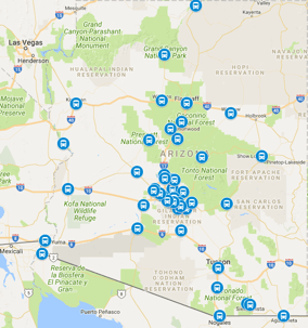
Kingman sits about 185 miles northwest of downtown Phoenix, and the drive between the Route 66 city and downtown runs roughly 3 hours door to door in normal traffic. The connection runs highway nearly the whole way: US-60 heads northwest from the Valley through the White Tank foothills to Wickenburg, where US-93 breaks north through the Joshua Forest Parkway, past Wikieup and the Santa Maria River, into Kingman at the foot of the Hualapais. It is Arizona's northwest corridor, carrying Route 66 sightseers, Hoover Dam day-trippers, Mojave travelers, and Laughlin-bound visitors between Kingman addresses and Sky Harbor. Because the distance is long but the road is open desert highway, most of the planning goes into the Wickenburg junction and the terminal curb. The Wickenburg run covers the first half of the route, and everything past the US-93 junction is Joshua-tree rhythm.
The US-60 Run to Wickenburg
From downtown Phoenix, US-60 heads west and then northwest on Grand Avenue through Glendale, Sun City, and Surprise, then opens into desert toward Wickenburg. That first leg is about 55 miles, usually just over an hour outside rush hour. Traffic bunches on Grand Avenue during commuter peaks, so northwest-bound travelers often leave the Valley mid-morning. Fuel and restroom stops cluster in Surprise and Wickenburg, roughly the one-third and halfway marks. Summer heat across this stretch is fierce, so vehicles idle with air conditioning at every stop and drivers carry extra water for roadside waits. The Lake Havasu City run shares this same highway all the way to Wickenburg, which is why shuttle drivers treat Kingman and Havasu as sister trips.
US-93 North Through Joshua Forest
At Wickenburg, roughly 55 miles from downtown Phoenix, the route leaves US-60 for US-93 north. This 130-mile leg runs about 2 hours through the Joshua Forest Parkway, past the Santa Maria River crossing and the wide stop at Wikieup, then climbs gently into Kingman. The road is a divided highway for much of the way with long open stretches, and it carries a steady mix of Las Vegas-bound traffic, boat towers, and Route 66 cruisers. Night driving here means long dark miles with burros near the washes, so evening arrivals take it steady. Cell coverage is thin in a few dips between Wikieup and Kingman, which is why drivers confirm the Kingman meeting point before leaving Wickenburg. The turn into Kingman lands travelers on Beale Street, the historic Route 66 main drag.
Beale Street, Route 66, and Hoover Dam Days
Most Kingman visits center on Beale Street's Route 66 Museum, the historic depot, and the classic neon blocks east of downtown. The Hualapai foothills offer short scenic drives, and the London Bridge at Lake Havasu makes a classic side trip to the west. Hoover Dam sits about an hour northwest via US-93, an easy day trip that pairs naturally with a Kingman overnight. Parking on Beale Street is easy on weekdays but fills during Route 66 events and spring rally season, so shuttle drop-offs at the depot corner save a search. A typical visit runs one to two nights, which leaves a comfortable buffer for the three-hour return to a midday flight.
Airport Timing From Mohave County
Sky Harbor is the practical commercial airport for Kingman trips, so every itinerary works backward from the terminal curb. For a domestic departure, plan to reach the curb two hours before boarding, which means leaving Kingman about five hours before wheels-up once the drive, rental return, and terminal walk are counted. Midday flights out of Phoenix pair best with this run, since a morning departure from Kingman clears Wickenburg before lunch and reaches the terminals with room to spare. Evening red-eyes work too, with a late-afternoon Beale Street finish and a sunset drive down US-93. During monsoon season, blowing dust can slow the Wikieup stretch, so summer itineraries add thirty minutes.
Booking the Ride and What to Tell Dispatch
Door-to-door service is the norm on this corridor: drivers collect travelers from Kingman hotels, Beale Street corners, and Hualapai-foothill ranches, then run them straight to the Sky Harbor curb. Shared-ride scheduling groups Wickenburg and Kingman pickups into the same vehicle when timing allows, which keeps the long highway leg efficient. Private rides suit Hoover Dam day-trip timing and Route 66 photo stops that do not fit a fixed timetable. Give the exact Kingman street or ranch name when booking, because similarly named Route 66 addresses repeat across Mohave County and mapping pins drift on the rural roads. Return trips meet arrivals at the Sky Harbor curb by terminal, then reverse the route with a restroom pause at Wikieup. Drivers track inbound flights, so delayed landings shift the Wickenburg rendezvous without a phone chase.
Kingman Trip Questions
Can you do Kingman as a day trip from Phoenix?
It is a long day but a doable one: three hours each way plus four hours on Beale Street and the Route 66 Museum makes a ten-hour outing. Most day-trippers leave the Valley by 7 a.m. Travelers adding Hoover Dam usually stay a night.
Is the road to Kingman difficult to drive?
No. US-60 to Wickenburg is wide highway, and US-93 north is a maintained divided highway most of the way. The only cautions are burros after dark and monsoon dust in summer, both of which professional drivers on this corridor handle daily.
How much time do I need on Route 66 in Kingman?
The museum, depot, and Beale Street neon take three to four hours at an easy pace. Add lunch downtown and the Hualapai foothill drive, and the classic visit totals a full day.
Which Phoenix airport serves Kingman?
Phoenix Sky Harbor is the practical choice at about three hours. Kingman Airport has limited regional service, so most out-of-state visitors fly into Sky Harbor and ride northwest.
Quick Distance & Time Summary
TravelMath reports a driving distance of 196 mi (315 km) with a typical drive of 3 h 12 min between Kingman and Phoenix TravelMath. Check‑Distance lists a slightly shorter 181 mi (291 km) route that takes 3 h 29 min Check‑Distance. The straight‑line (flight) distance is about 165 mi (266 km), translating to a 19‑minute flight TravelMath. The table below puts the key numbers side‑by‑side for quick scanning.
| Metric | TravelMath | Check‑Distance | How‑Far.net |
|---|---|---|---|
| Driving distance | 196 mi / 315 km | 181 mi / 291 km | 181 mi / 291 km |
| Drive time (normal traffic) | 3 h 12 min | 3 h 29 min | 3 h 29 min |
| Flight distance | 165 mi / 266 km | — | — |
| Flight time | ≈ 19 min | — | — |
Alternative Driving Routes Compared
The fastest corridor follows US‑60 west to Grand Avenue, then US‑93 north through Wickenburg and the Joshua Forest Parkway — about 181 mi and 3 h 29 min Check‑Distance. A secondary option adds a loop via I‑40 west to US‑66 (Andy Devine Avenue) before reaching Kingman, stretching the trip to roughly 203 mi and 4 h 18 min Check‑Distance. Both routes stay on divided highways; the longer version simply adds mileage through the historic Route 66 alignment. Drivers who prefer the classic Mother Road experience often choose the longer path for the neon‑lit Beale Street approach.
Fuel Cost Estimates (Gas & Diesel)
Using the 181‑mile baseline, a vehicle averaging 31.4 mpg with gasoline at $4.48 / gal would consume about 7.84 gal for an estimated fuel cost of $25.80 (estimate) Check‑Distance. The same trip with diesel at $6.51 / gal and 52.3 mpg drops the estimate to $22.52 Check‑Distance. Car‑pooling two passengers halves the per‑person cost to roughly $12.90 (gas) or $11.26 (diesel). These figures are estimates only and will vary with actual fuel prices and vehicle efficiency.
Kingman Elevation & Coordinates
Kingman sits at 3,333 ft (1,016 m) above sea level, while Phoenix rests at 1,086 ft (331 m) TravelMath. The geographic coordinates are 35.20833° N, ‑114.02583° W for Kingman and 33.450° N, ‑112.067° W for Phoenix. Knowing the elevation change helps travelers anticipate cooler temperatures in Kingman, especially after sunset.
Planning Tools & Calculators
For travelers who like to calculate their own numbers, free online distance calculators (e.g., TravelMath, Check‑Distance, How‑Far.net) let you input the exact start and end addresses, choose a vehicle’s MPG, and instantly see gallons needed, fuel cost, and alternative routes. Our Wickenburg guide and Lake Havasu City guide also embed similar calculators for the first half of the corridor.
Where to Stay in Kingman
Kingman offers a handful of hotels within walking distance of Beale Street and the Route 66 Museum: the historic Hotel Beale, the modern Holiday Inn Express Kingman, and several budget‑friendly motels along US‑93. Booking a room near the depot corner simplifies shuttle pick‑up — drivers can meet you at the curb without navigating the wider Mohave County road network.
FAQ: Kingman to Phoenix Distance
How far is it from Kingman, AZ to Phoenix, AZ?
The most commonly cited driving distance is 181 mi (291 km) via US‑60/US‑93, taking about 3 h 29 min in normal conditions Check‑Distance. TravelMath lists a slightly longer 196 mi figure, reflecting a marginally different routing.
What is the fastest route from Phoenix to Kingman?
Take Grand Avenue (US‑60) northwest to Wickenburg, then follow US‑93 north through the Joshua Forest Parkway directly into Kingman. This 181‑mile corridor is the quickest, typically 3 h 29 min.
Are there tolls on the Phoenix‑Kingman drive?
No. The entire route uses free federal and state highways (US‑60, US‑93, and a short stretch of I‑40 if you choose the longer Route 66 alignment).
How much gas will I need for the round trip?
At 31.4 mpg, a round‑trip of 362 mi consumes roughly 11.5 gal of gasoline. Adjust for your vehicle’s actual MPG.
Can I fly from Kingman to Phoenix?
Kingman Airport (IGM) handles general aviation only; there is no scheduled commercial service. The nearest commercial airport is Phoenix Sky Harbor (PHX), a 165‑mile straight‑line flight of about 19 minutes, but you would still need ground transport to reach the terminal.
What should I pack for a summer drive?
Carry extra water, sun protection, and a fully charged phone. Cell coverage thins between Wikieup and Kingman, and monsoon dust storms can reduce visibility on US‑93. A portable charger and printed map are wise backups.
Is there a shuttle service for this corridor?
Yes. Airport Shuttle of Phoenix runs door‑to‑door shared and private rides between Kingman hotels, Beale Street addresses, and Sky Harbor terminals. Drivers track inbound flights and coordinate a restroom stop at Wikieup on the return leg.
Last updated: 2025‑09‑27