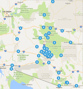
Mesa Gateway Airport, coded AZA, sits about 20 miles east of downtown Phoenix, and the drive usually takes twenty-five to thirty-five minutes via Loop 202. It is a completely different airport from Phoenix Sky Harbor International Airport (PHX), which catches first-time visitors off guard, so confirm the three-letter code on the ticket before heading out. The airport serves mostly leisure carriers with nonstop routes across the western and midwestern states, and it is the closest airport for the East Valley, including Mesa, Gilbert, Chandler, and Queen Creek. Our vans run this hop constantly...
Recent Posts
How Far Is Lake Powell From Phoenix
October 31, 2026
Lake Powell sits about 280 miles north of Phoenix, and the drive to Wahweap Marina near Page usually takes four and a half to five hours without long stops. The standard route runs up I-17 to Flagstaff and then north on US-89 to Page, which keeps things simple because it is almost entirely divided highway until the last stretch. Travelers headed for houseboat check-ins, Antelope Canyon tours, or a weekend at the lake should treat this as a full travel day, not a quick hop, since the last hour crosses open high-desert country with few services. Our private vans run this corridor for groups...
How Far Is Havasu Falls From Phoenix
October 31, 2026
Havasu Falls sits about 210 driving miles northwest of Phoenix, and reaching the Hualapai Hilltop trailhead usually takes three and a half to four hours. That is only the driving part: from the trailhead it is roughly ten more miles on foot down into the canyon to the falls, so this trip is an expedition, not a day drive. Permits from the Havasupai Tribe are required for every visitor and sell out far in advance, and day hiking is not permitted. Hiking parties commonly stage out of Kingman, Peach Springs, or Seligman the night before, and our vans move groups from the Valley to those staging...
How Far Is Arizona State University From Phoenix
October 31, 2026
Arizona State University's Tempe campus sits about 12 miles southeast of downtown Phoenix, and the drive usually takes twenty to thirty minutes via I-10 or US-60. ASU is one of the largest universities in the country, so move-in weeks, parents weekend, orientation, and home football games at Mountain America Stadium all generate serious family travel. Visiting parents often land at Phoenix Sky Harbor International Airport (PHX) with extra luggage and head straight to a Tempe hotel or dorm, which is exactly the trip our vans run daily. The same flat-rate structure described in our Gilbert...
How Far Is Old Town Scottsdale From Phoenix
October 31, 2026
Old Town Scottsdale sits about 12 miles northeast of downtown Phoenix, and the drive usually takes twenty to thirty minutes depending on traffic and events. The district packs galleries, tasting rooms, boutiques, and nightlife into a walkable grid around Scottsdale Road and Main Street, which makes it one of the most requested evening destinations from Phoenix hotels. Spring training, Barrett-Jackson week, and the spring arts festivals can stretch the trip toward forty minutes, so event nights deserve a buffer. Our vans run this hop nightly for dinner groups and wedding parties, and the same...
How Far Is Civana From Phoenix
October 31, 2026
How far is Civana from Phoenix? About 38 miles and roughly an hour door to door in normal traffic, north on SR-51 and Scottsdale Road through the foothills into Carefree. Civana is the high desert's wellness address: the resort spa and movement studios, the desert gardens and labyrinth walks, the pool decks and healthy kitchens, and a calendar of retreats that draws solo travelers, couples, and small groups from everywhere. Retreat guests, spa weekends, wellness groups, and travelers combining a reset with a Scottsdale stay all share one ground leg: the foothill ride from Sky Harbor to the...
How Far Is Antelope Canyon From Phoenix
October 31, 2026
How far is Antelope Canyon from Phoenix? About 275 miles and roughly four and a half to five hours door to door in normal traffic, north on I-17 to Flagstaff, north on US-89 past Cameron, then into Page and the canyon meeting points. Antelope Canyon is the Southwest's most photographed slot canyon: Upper Antelope's light beams, Lower Antelope's ladders and twists, water-sculpted sandstone walls on Navajo Nation land, and tours that run on strict fixed slots with no self-guided entry. Photography travelers, bucket-list families, honeymoon couples combining the canyon with Horseshoe Bend, and...
How Far Is State Farm Stadium From Phoenix
October 31, 2026
How far is State Farm Stadium from Phoenix? About 18 miles and roughly half an hour door to door in normal traffic, west on I-10 to Loop 101 north into the Glendale sports district. State Farm Stadium is the West Valley's big-event anchor: Cardinals home games, the Fiesta Bowl, headline concerts, international soccer, and the Westgate Entertainment District across the street with its restaurants and pre-game crowds. Game-day travelers, concert groups, bowl-week visitors, and families combining a game with a Valley vacation all share one ground leg: the freeway ride from Sky Harbor to the...
How Far Is Waddell From Phoenix
October 31, 2026
How far is Waddell from Phoenix? About 35 miles and roughly 50 minutes to an hour door to door in normal traffic, west on I-10 to Loop 303 north, then west toward the White Tank foothills. Waddell is the West Valley's desert-edge community: large-lot homes and farm properties along the White Tank Mountain front, the massive White Tank Mountain Regional Park with its waterfall petroglyph trails, and quiet roads where the suburbs give way to open desert. Park hikers, family visitors, farm-property guests, and travelers with roots in the old West Valley ranch country all share one ground leg:...
How Far Is Yarnell From Phoenix
October 31, 2026
How far is Yarnell from Phoenix? About 80 miles and roughly an hour and a half door to door in normal traffic, northwest on US-60 through the suburbs to Wickenburg, then northeast on US-93 and SR-89 up Yarnell Hill into town. Yarnell is the high-desert hideaway above the Hassayampa Plain: the mile-long Yarnell Hill grade, antique shops and pie stops along the old highway, the Shrine of Saint Joseph trail, and ranch properties scattered across the surrounding hills. Retirees visiting family, antique hunters, shrine pilgrims, and travelers with roots in the old mining district all share one...
How Far Is Petrified Forest From Phoenix
October 31, 2026
How far is Petrified Forest from Phoenix? About 200 miles and roughly three to three and a half hours door to door in normal traffic, north on I-17 to Flagstaff, then east on I-40 past Winslow to Holbrook and the park's south entrance. Petrified Forest is Arizona's open-air time capsule: the Rainbow Forest Museum and its giant logs, the Painted Desert rim drives at the north end, the Blue Mesa badlands loop, and Ancestral Puebloan sites along the park road. Geology classes, Painted Desert photographers, Route 66 families doubling the park with the old highway, and travelers combining the park...
How Far Is Monument Valley From Phoenix
October 31, 2026
How far is Monument Valley from Phoenix? About 315 miles and roughly five and a half to six hours door to door in normal traffic, north on I-17 to Flagstaff, north on US-89 past Cameron, then east on US-160 through Kayenta to the tribal park entrance. Monument Valley is the American West in one view: towering sandstone buttes on Navajo Nation land, the tribal park loop road, guided backcountry tours into areas private vehicles cannot enter, and sunrise and sunset crowds at the visitor center overlook. Photography groups, guided-tour travelers, family road-trippers on the canyon circuit, and...
How Far Is San Carlos From Phoenix
October 31, 2026
How far is San Carlos from Phoenix? About 110 miles and roughly two to two and a quarter hours door to door in normal traffic, east on US-60 through Apache Junction and the Superior grade to Globe, then southeast on US-70 into San Carlos. San Carlos is the Apache community at the western gateway of the reservation: the tribal offices and health facilities, the cultural center and veterans memorial, family homes across the community districts, and the lake and river recreation country beyond. Tribal-business travelers, health-facility visitors, family gatherings, and outdoors travelers bound...
How Far Is Aguila From Phoenix
October 31, 2026
How far is Aguila from Phoenix? About 80 miles and roughly one hour twenty-five minutes door to door in normal traffic, northwest on US-60 past Wickenburg into the irrigated farm country of the western desert. Aguila is a small farming town in the open desert: melon and vegetable fields, equipment yards, the roadside stops on the US-60 truck route, and families tied to the planting and harvest seasons. Farmworkers traveling for the seasons, equipment and supply buyers, and families visiting across the harvest all share one ground leg: the desert-highway ride from Sky Harbor to the western...
How Far Is Sun Lakes From Phoenix
October 31, 2026
How far is Sun Lakes from Phoenix? About 30 miles and roughly forty minutes door to door in normal traffic, south on I-10 then into Chandler and down to the lake-dotted active-adult community. Sun Lakes is a large retirement resort community: five country-club phases around small lakes, golf courses, clubhouses, and gates that every visitor learns to navigate. Snowbirds settling in for the season, golf groups flying in for long weekends, and visiting family members all share one ground leg: the short freeway ride from Sky Harbor to the southern suburbs. It sits just past the well-covered how...
How Far Is Youngtown From Phoenix
October 31, 2026
How far is Youngtown from Phoenix? About 25 miles and roughly thirty-five minutes door to door in normal traffic, northwest on US-60 and the surface arterials into the retirement community beside Sun City. Youngtown is a small active-adult town: quiet block grids, the historic town square, clubhouses and activity centers, and longtime residents who planned their retirement around the desert sun. Visiting children and grandchildren, snowbird renters settling in for the season, and medical travelers with appointments at the West Valley hospitals all share one ground leg: the short crosstown...
How Far Is Cornville From Phoenix
October 31, 2026
How far is Cornville from Phoenix? About 100 miles and roughly one hour forty-five minutes door to door in normal traffic, north on I-17 to the Verde Valley country, then off the interstate onto the farm roads along the Verde River. Cornville is the Verde Valley farm town: irrigated fields, orchards, and vineyards along the river, the Page Springs fish-hatchery and wine-tasting corridor, and families who farm the bottomland their grandparents cleared. Wine tasters, farm-stand visitors, and reunion groups gathering on river properties all share one ground leg: the mountain-grade ride from Sky...
How Far Is Ajo From Phoenix
October 31, 2026
How far is Ajo from Phoenix? About 110 miles and roughly two hours door to door in normal traffic, west on I-10 then south on AZ-85 through Gila Bend into the desert country around the old open-pit mine. Ajo is a historic copper-mining town turned desert-art community: the curving plaza with its Spanish-style arcades, the vast mine overlook, the Organ Pipe gateway traffic, and snowbirds who found the quiet corner of the Sonoran Desert. Mine-history visitors, desert travelers staging for the border parks, and winter residents all share one ground leg: the long two-lane ride from Sky Harbor to...
How Far Is Salome From Phoenix
October 31, 2026
How far is Salome from Phoenix? About 105 miles and roughly one hour forty minutes door to door in normal traffic, west on I-10 past Tonopah and the Harquahala Plain, then north off the interstate into the ranch and desert-homestead country around Salome. Salome is a small desert community on the edge of the Harquahala Mountains: ranch properties, off-grid homesteads, RV lots, and the roadside stops that serve travelers crossing the western desert. Ranch families, desert homesteaders flying in for supplies and visits, and hunters and rockhounds working the backcountry all share one ground...
How Far Is San Luis From Phoenix
October 31, 2026
How far is San Luis from Phoenix? About 185 miles and roughly three hours door to door in normal traffic, west on I-8 across the desert to Yuma, then south into the irrigated farm towns at the southern edge of Arizona. San Luis is a working farm community: lettuce and vegetable fields, packing sheds, equipment yards, and close-knit neighborhoods where extended families share homes and rides to the airport. Farmworkers heading home for the holidays, families visiting relatives on both sides of town, and seasonal residents crossing through Yuma all share one ground leg: the long desert ride...