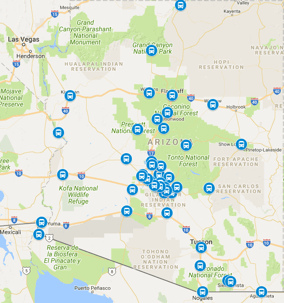
How far is Chinle from Phoenix? About 290 miles and roughly five hours door to door in normal traffic, northeast on AZ-87 up the Beeline Highway through Payson and Heber-Overgaard, then east on AZ-260 and north on AZ-77 and US-191 through the high desert into the red-rock canyon country. Chinle is the Canyon de Chelly gateway: a high-desert community on the Navajo Nation at the mouth of the canyon, serving canyon tours, tribal offices, the regional schools, and travelers bound for the rim drives and the ancient cliff dwellings. Canyon tour groups, jeep-tour mornings, tribal-business...
Recent Posts
How Far Is Sun City West From Phoenix
October 30, 2026
How far is Sun City West from Phoenix? About 30 miles and roughly 40 minutes door to door from Sky Harbor in normal traffic, northwest out of the airport corridor to I-17, north past the Loop 101 stack, then west on Bell Road into the heart of the retirement community. Sun City West is the younger sibling of the original Sun City: a master-planned active-adult community of golf courses, recreation centers, and gated subdivisions wrapped around the Banner Boswell medical corridor. Winter visitors renting for the season, grandparents flying in to see family, golfers on desert-course rotations,...
How Far Is Prescott Valley From Phoenix
October 30, 2026
How far is Prescott Valley from Phoenix? About 85 miles and roughly an hour and a half door to door from Sky Harbor in normal traffic, north on I-17 up the Black Canyon grade, over the Sunset Point climb, then east on AZ-69 into the high-desert valley. Prescott Valley has grown from a ranching outpost into one of the fastest-growing towns in northern Arizona, a spread of subdivisions, event-center crowds, and retail corridors set between Prescott and Dewey at a mile of elevation. Commuters with Sky Harbor flights, families in the Granville and Viewpoint neighborhoods, event-goers at the...
How Far Is Vail From Phoenix
October 30, 2026
How far is Vail from Phoenix? About 140 miles and roughly two hours and ten minutes door to door from Sky Harbor in normal traffic, southeast on I-10 past Casa Grande and Picacho Peak, past the Marana and Tucson interchanges, then into the Rincon foothills community. Vail is the fast-growing southeastern suburb: master-planned neighborhoods filling the desert between the interstate and the Rincon Mountains, Colossal Cave drawing cavern visitors, Saguaro East trailheads staging hikers, and school-district families commuting across the whole metro. New-home families flying out for the holidays,...
How Far Is Oracle From Phoenix
October 30, 2026
How far is Oracle from Phoenix? About 100 miles and roughly an hour and fifty minutes door to door from Sky Harbor in normal traffic, southeast on US-60 through Apache Junction and Gold Canyon, south on AZ-79 through Florence, then east on AZ-77 through Oracle Junction into the high-desert town. Oracle is a quiet foothill community tucked against the northern Catalinas: the Biosphere 2 research campus drawing science visitors, Arizona Trail hikers staging resupplies, winter renters in the high-desert subdivisions, and ranch families working the surrounding grasslands. Science-center visitors...
How Far Is Safford From Phoenix
October 30, 2026
How far is Safford from Phoenix? About 165 miles and roughly two and three-quarter hours door to door from Sky Harbor in normal traffic, east on US-60 through Apache Junction and Superior, over the Queen Creek grade past Miami and Globe, then southeast on US-70 through the farm towns into Safford. Safford anchors the Gila Valley: cotton and chile fields, the Mount Graham foothills rising behind town, Eastern Arizona College drawing students and parents, and the big mine operations running shifts around the clock. College families on move-in weekends, miners on crew rotations, farm families...
How Far Is Tubac From Phoenix
October 30, 2026
How far is Tubac from Phoenix? About 200 miles and roughly three hours door to door from Sky Harbor in normal traffic, southeast on I-10 past Casa Grande and Picacho Peak, then south on I-19 through Green Valley into the Santa Cruz valley gallery town. Tubac is Arizona's artists' colony: adobe studios and galleries lining the old presidio streets, the Tumacacori mission park minutes south, snowbird casitas filling for the winter, and festival weekends that double the little town overnight. Gallery-hoppers on day escapes, winter renters settling into casitas, festival-goers timing the art...
How Far Is Benson From Phoenix
October 30, 2026
How far is Benson from Phoenix? About 150 miles and roughly two and a third hours door to door from Sky Harbor in normal traffic, southeast on I-10 past Casa Grande and Picacho Peak, through Texas Canyon, then into the San Pedro valley. Benson is a railroad and ranch town turned sky-island gateway: Kartchner Caverns staging, Butterfield stage history, RV parks along the San Pedro River, and mine and rail workers on rotation. Cavern visitors timing tour slots, RVers wintering along the river parks, history buffs working the stage routes, and workers on the mine and rail schedules all share one...
How Far Is Jerome From Phoenix
October 30, 2026
How far is Jerome from Phoenix? About 115 miles and roughly two hours door to door from Sky Harbor in normal traffic, north on I-17 over the grades, west through Cottonwood on AZ-260, then up the AZ-89A switchbacks into the hillside town. Jerome is Arizona's famous mountainside mile-high town: a former copper camp turned gallery and wine destination, its hotels and shops clinging to Cleopatra Hill above the Verde Valley. Gallery-hoppers on weekend stays, wedding parties booking the hillside hotels, wine-trail visitors working the Cottonwood tasting rooms, and history buffs touring the mine...
How Far Is Winslow From Phoenix
October 30, 2026
How far is Winslow from Phoenix? About 190 miles and roughly three hours door to door from Sky Harbor in normal traffic, northeast on the Beeline Highway through Fountain Hills and Payson, over the Mogollon Rim country, then across the high plains into Winslow. Winslow is classic Route 66 Arizona: the standing-on-the-corner park, the La Posada hotel, rail yards that still work around the clock, and the Meteor Crater turnoff drawing road-trippers from everywhere. Route 66 tourists staging a night, rail and logistics workers on rotation, families visiting across Navajo County, and crater-bound...
How Far Is Chino Valley From Phoenix
October 30, 2026
How far is Chino Valley from Phoenix? About 95 miles and roughly an hour and three-quarters door to door from Sky Harbor in normal traffic, north on I-17 over the grades, east on AZ-69 through Prescott Valley, then north on AZ-89 into the wide ranch valley. Chino Valley is working ranch country turned high-desert suburb: hay fields and horse properties along the old highway, new subdivisions filling the flats, and a main-street corridor serving the whole upper valley. Ranch families with Sky Harbor flights, horse owners hauling show schedules, workers commuting to the Prescott-area employment...
How Far Is Nogales From Phoenix
October 30, 2026
How far is Nogales from Phoenix? About 180 miles and roughly two and three-quarter hours door to door in normal traffic, southeast on I-10 past Casa Grande and Picacho Peak, then south on I-19 through Green Valley into the Santa Cruz valley. Nogales anchors the far southern end of the I-19 corridor at the international port area, the county seat of Santa Cruz County, and its airport run is one of the longest regularly booked rides in the state. Shoppers visiting the historic downtown, families with relatives on both sides of the line, birders working the valley preserves, and business...
Greer to Phoenix Airport Shuttle Guide
October 28, 2026
Greer to Phoenix is the high-country cabin airport run: about 225 miles and roughly four and a half hours door to door in normal traffic, running from the highest cabin town in the state down through Show Low and the Salt River Canyon to the Valley floor. Greer sits at about 8,300 feet in a pocket of the White Mountains, a village of log cabins, the lodge, trout streams, and ski crowds, ringed by national forest. Cabin owners, ski families, trout anglers, fall-color visitors, and high-country households flying out of Sky Harbor all share one corridor west: SR-373 out to SR-260, west through...
Casas Adobes to Phoenix Sky Harbor runs about 105 to 110 miles door to door, roughly 1 hour and 45 minutes to 2 hours in normal traffic, and it is a corridor where door-to-door service quietly outperforms every alternative. Casas Adobes sits in the northwest Tucson metro between the city and Oro Valley, which means every Sky Harbor trip threads Tucson surface streets before joining I-10 north. This guide covers the service in plain terms: when the driver collects you, what the ride looks like, how airport pickup works on the way home, and how to arrange the return. Corridor facts below follow...
Morenci to Phoenix Airport Shuttle Guide
October 26, 2026
Morenci to Phoenix is the copper-country airport run: about 175 miles and roughly three and a half hours door to door in normal traffic, dropping from the mining town on the San Francisco River through the Gila Valley to the Valley floor. Morenci sits at about 3,400 feet beside one of the largest open-pit copper operations in the country, a company town of mine-shift families, contractors on rotation, and households tied to the Clifton and Safford operations. Shift families flying out for time off, contractors rotating home, mine visitors and vendors, school and medical travelers bound for...
ASU Graduation to Phoenix Airport Shuttle Guide
October 26, 2026
ASU graduation turns the East Valley into one big family reunion twice a year: May and December commencements across four campuses pull in parents, grandparents, and siblings from every time zone, most of them landing at Sky Harbor within a day of each other. The main Tempe campus hosts the biggest ceremonies, but families also fly in for the Polytechnic campus in Mesa, the West Valley campus in Glendale, and the Downtown Phoenix campus, each with its own hotels, parking crunch, and ceremony-day road closures. Almost all of them land at Sky Harbor, and almost none of them are ready for what...
Explore The Beauty Of Flagstaff With Arizona Shuttle.
June 03, 2026
Spend your holidays and vaccinations enjoying these adventures and tours with your family and loved ones. Flagstaff travel guide Flagstaff travel guide
Scenic Horseback Adventure
It is a 1 hour guided horseback ride of the VerdeValley. They have different options for beginners, families, and children. The journey will help you explore the natural habitats of flora and fauna. The location will give you the old west feels, including western facades, horses, chickens, goats, and cows. You'll be given helmets for safety purposes, and you can click selfies or give the horses treats. During the...
Arizona is known for its diverse landscape, from deserts to mountains to forests, and Flagstaff is the perfect location for those looking to experience the great outdoors. Whether you're an avid hiker or enjoy being surrounded by nature, Flagstaff has something for everyone. With Arizona Shuttle, you can easily explore the area's outdoor adventures and make the most of your summer vacation. Here are some of the top activities to enjoy in Flagstaff:
Are you a foodie looking for a culinary adventure in Flagstaff? Look no further than the city's vibrant food truck scene! From classic American dishes to international flavors, there is something for everyone to enjoy. And the best way to explore it all? With Arizona Shuttle, of course!In this guide, we'll introduce you to some of the best food trucks in Flagstaff that you will want to take advantage of. Phoenix to Flagstaff shuttle traveling from Phoenix Flagstaff food scene guide distance to Flagstaff
Are you planning a trip to the Grand Canyon or Flagstaff this April? Then you are in luck, as Arizona offers much this spring! Whether you are interested in outdoor adventures, or cultural events or want to soak up some sun, Arizona has something for everyone. And what better way to travel around Arizona than with Arizona Shuttle? With comfortable and convenient transportation, you can sit back and enjoy the scenery while someone else takes care of the driving. Flagstaff transportation options