
Plan your road trips with our shuttle service to get the best experience. Apache trail is the perfect choice to experience a thriller and a fun-packed adventure. Road trips are the new trend that’s on. And it has not just been followed by the youth but also the adults who enjoy traveling close to scenic views and nature. The youth are crazy for solo rides, and the adults love traveling in their caravans. But the main goal behind it is to enjoy the journey and stay close to nature. And traveling is always the trend as people love to learn, understand and explore the lifestyles, cultures, and stories of different places. So take your step forward in creating memories with us.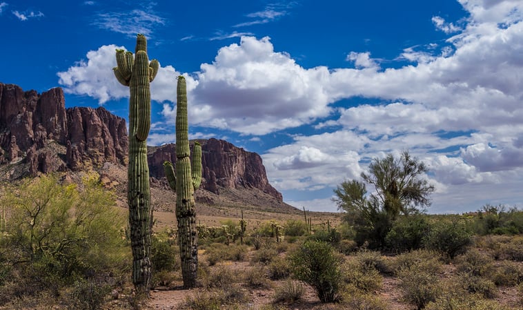
So we are here to recommend you to take the most awaited road trip through the apache trail covering superstition mountain, The Lost Dutchman Mine and Museum, Goldfield Ghost town, Canyon lake, Tortilla flat, etc. The trails missing out on these spots wouldn’t be recommended. These covered all together can give you an adrenaline rush through their ghostly beliefs, volcanic peaks, and many more.
As the name suggests, these places have a long history of superstitious or ghostly events which ended up as their names. Superstition Mountain history And many beliefs are still in the talk of the towns. Superstition Mountain is a volcanic cliff that has a legendary story behind it that states gold has been buried in the superstitious ranges. Yet many facts are yet to unfold.
The museum mentioned above is believed to have a collection of astonishing artifacts related to legendary history. Whereas Tortilla flat is an old western town amidst the Tonto National Forest. This place is well known for its old-town burger and the refreshing taste of chili & salsa. And as we speak of canyon lake this place is the perfect spot to enjoy the starry night's cruise rides. Canyon Lake night cruises So plan the perfect road trip amongst the trails being the closest to nature and historical events. Bringing you the chance for an adventurous and mind-boggler holiday.
Arizona shuttles will make your trip a perfect one with its expert services, doorstep pick up and drop off facility, assured safety to the passengers as we run background checks of our drivers nationwide, and flexibility in making any changes in date and time at any point of time without any charge. Our service is available 24\7. We provide SUVs, shuttle service, and even pre-booked limo options to make your journey budget-friendly. Book your ride now and for more information, contact us at (480) 710-3441 or airportshuttlephoenix@gmail.com.
Why the Apache Trail Is One of Arizona’s Top Scenic Drives
The Apache Trail, officially designated as State Route 88 (SR 88), stretches roughly 42 miles from Apache Junction to Roosevelt Lake and has earned a reputation as one of the most picturesque drives in the American Southwest. Early travelers praised the route as “one of the best and most delightful scenic routes in the whole of the mountain regions in the United States” in a 1913 Arizona Good Roads Association tour book. In 1915 the Pacific Railroad Company began promoting the road as a tourist attraction and coined the name “The Apache Trail.” In 1988 the trail became Arizona’s first “Historic and Scenic Highway,” a title it still holds today (source: americansouthwest.net). The corridor threads through the Sonoran Desert, past volcanic cliffs, shimmering lakes, and historic ghost towns, making it a must‑see for anyone visiting central Arizona.
Major Stops Along the Apache Trail (SR 88)
The route is lined with a series of iconic landmarks that showcase the region’s natural beauty and frontier history. Below is a concise guide to the key stops, their approximate distances from Apache Junction, and what makes each worth a pause.
1. Apache Junction & the Superstition Mountains
Just a few miles east of Phoenix, Apache Junction marks the trailhead where suburbia gives way to the towering Superstition Mountains. The volcanic cliffs rise abruptly from the desert floor, and legend says gold was buried somewhere in these ranges during the late 1800s. The Lost Dutchman State Park, located at the foot of the mountains, offers easy access to several hiking trails and interpretive displays about the area’s mining past (source: justsimplywander.com).
2. Goldfield Ghost Town
About 8 miles southeast of Apache Junction, Goldfield Ghost Town stands as a reminder of the rapid rise and fall of Arizona’s mining boom towns. Gold was first discovered in the Superstition Mountains in the late 1800s, and Goldfield quickly grew into one of the largest mining towns in the region. After only five years, the mine veins faulted and the town was abandoned almost as quickly as it had appeared (source: americansouthwest.net). Today, visitors can explore restored buildings, a museum, and the site’s famous wooden boardwalk, which was also used as a filming location for the 1969 movie Charro starring Elvis Presley.
3. Canyon Lake & the Marina
Continuing south, Canyon Lake appears as a jewel of the desert. The lake, formed by the damming of the Salt River, is ideal for kayaking, paddle‑boarding, and scenic boat tours, especially the popular starlight cruises that let guests view the night sky over the water. The Canyon Lake Marina serves as a gateway to several water‑based activities and provides basic amenities for travelers (source: justsimplywander.com).
4. Tortilla Flat
At roughly 20 miles from Apache Junction, Tortilla Flat claims the title of Arizona’s smallest official town, with a current population of six. The village, established in 1906, is famous for its old‑western burger joint, authentic chili, and salsa, as well as the historic one‑room schoolhouse built in 1932 that once educated 14 students (source: americansouthwest.net). The overlook located about 7 miles beyond Tortilla Flat offers sweeping views of the surrounding canyon country.
5. Fish Creek Vista Overlook
This viewpoint provides one of the most dramatic panoramas along the trail. From here you can see the rugged Fish Creek Canyon and the winding road descending toward Apache Lake. The overlook is a favorite spot for photographers, especially during sunrise and sunset.
6. Apache Lake
Further along, Apache Lake stretches across 34 square miles, making it the third‑largest man‑made lake in the world after Lake Powell and Lake Mead (source: justsimplywander.com). The lake is flanked by steep canyon walls and offers excellent fishing for bass and trout. In 2019 the Woodbury Fire caused flooding that washed out about five miles of road just after Fish Creek Vista; the affected segment reopened in September 2024 after extensive repairs, and a high‑clearance 4WD vehicle is now required for this portion (source: americansouthwest.net).
7. Roosevelt Dam & Roosevelt Lake
The final major milestone is the Roosevelt Dam, constructed between 1905 and 1911, which created Roosevelt Lake. The dam’s massive concrete arch is a historic engineering feat and the lake serves as a vital water supply for central Arizona. The 13‑mile stretch from the marina to Roosevelt Dam is open to foot traffic only, inviting hikers and cyclists to explore the lakeshore (source: americansouthwest.net). Amenities are limited; the nearest town, Globe, lies about 40 miles away, so travelers should plan supplies accordingly.
Comparison Table: Key Stops on the Apache Trail
| Stop | Approx. Distance from Apache Junction (mi) | Highlights | Best For |
|---|---|---|---|
| Apache Junction & Superstition Mountains | 0–5 | Volcanic cliffs, Lost Dutchman State Park, historic trails | Hiking, legend‑seeking |
| Goldfield Ghost Town | ~8 | Restored mining structures, museum, movie set history | History buffs, ghost‑town enthusiasts |
| Canyon Lake & Marina | ~12 | Water sports, starlight cruises, scenic vistas | Boating, photography |
| Tortilla Flat | ~20 | Smallest AZ town, classic burger joint, historic schoolhouse | Local culture, casual dining |
| Fish Creek Vista Overlook | ~25 | Panoramic canyon views, easy pull‑out | Scenic drives, photography |
| Apache Lake | ~30 | Third‑largest man‑made lake, fishing, high‑clearance road | Fishing, off‑road adventure |
| Roosevelt Dam & Lake | ~42 | Historic dam, 13‑mile foot‑only lakeside stretch, limited services | History, hiking, remote exploration |
Historical Background & Naming of the Apache Trail
The route’s popularity as a scenic drive began in the early 20th century. In 1913 the Arizona Good Roads Association described it as one of the best mountain routes in the United States, a claim that spurred local promoters to market it to tourists. By 1915 the Pacific Railroad Company officially labeled the road “The Apache Trail,” drawing travelers eager to experience the desert and mountainous terrain. The name stuck, and in 1988 the Arizona Department of Transportation designated the entire 42‑mile stretch as the state’s first “Historic and Scenic Highway.” This legacy makes the Apache Trail not only a natural wonder but also a cultural artifact of early Arizona tourism (source: americansouthwest.net).
Outdoor Activities & Hiking Opportunities
Beyond driving, the Apache Trail offers rewarding hikes. One standout is the 12.8‑mile out‑and‑back trek to a seasonal waterfall that cascades nearly 200 feet. The trail gains about 3,316 feet in elevation, making it strenuous but rewarding for fit hikers. A permit is required for this hike, and the path leads to a mini‑Havasu‑style waterfall that dazzles visitors during peak flow (source: justsimplywander.com). Other popular trails include the short interpretive walks at Lost Dutchman State Park and the lakeside paths near Canyon Lake, suitable for families and casual walkers.
Road Conditions, Safety Tips & Practical Information
- Vehicle Requirements: The segment from Fish Creek Vista to Apache Lake reopened in September 2024 after flood damage; it now requires a high‑clearance 4WD vehicle, and towing a camper or trailer is prohibited (source: americansouthwest.net).
- Foot‑Only Section: The 13‑mile stretch from the marina to Roosevelt Dam is closed to motor vehicles and open only to hikers and cyclists, offering a peaceful lakeside experience.
- Services: Facilities are sparse beyond Apache Junction, Canyon Lake Marina, and Tortilla Flat. Stock up on fuel, food, and water before departing, especially if you plan to explore the remote segments.
- Weather Considerations: Summer temperatures can exceed 100 °F; start early in the day and carry ample hydration. Monsoon rains from July to September may cause temporary road closures.
- Maps & Navigation: While GPS works for most of SR 88, a physical map or a downloadable offline route is advisable for the more rugged portions.
Planning Your Visit: Getting There with Airport Shuttle of Phoenix
If you prefer to focus on the scenery rather than driving, Airport Shuttle of Phoenix offers door‑to‑door transportation along the Apache Trail corridor. Their fleet includes SUVs and shuttle vans, allowing you to sit back and enjoy the views without worrying about navigation or parking. The service operates 24 hours a day, and you can make date or time changes at no extra charge. To reserve a ride or obtain more details, call (480) 710‑3441 or email airportshuttlephoenix@gmail.com.
Frequently Asked Questions
- How long is the Apache Trail?
- The official scenic segment along State Route 88 runs about 42 miles from Apache Junction to Roosevelt Lake (source: americansouthwest.net).
- Is the Apache Trail suitable for RVs or trailers?
- Most of the route is open to standard vehicles, but
