
Arizona is home to a few of the most breathtaking natural landscapes in the United States, making it a most visited destination for hikers and outdoor enthusiasts. With Arizona Shuttle, visitors can easily access some of the state's best hiking trails, from the towering cliffs of the Grand Canyon to the stunning red rock formations of Sedona. In this blog post, we'll explore some of the best hiking trails in Arizona that are easily accessible by shuttle.
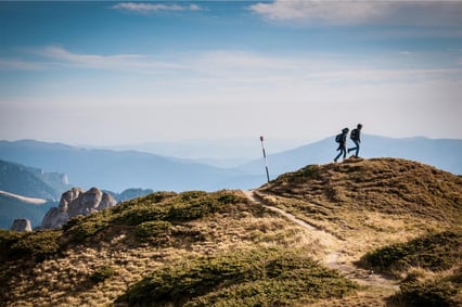
Camelback Mountain - Phoenix
Camelback Mountain is one of the most iconic hiking destinations in Arizona. The mountain in the heart of Phoenix offers two summits, Camelback and Echo, which provide stunning views of the city skyline and surrounding landscape. The trail is challenging, with steep inclines and rocky terrain, but well worth the effort for the incredible panoramic views at the top. For a less strenuous hike, the Cholla Trail offers a less steep ascent and equally stunning views. Sedona hiking access
Cathedral Rock - Sedona
Cathedral Rock is one of Sedona's most beloved hiking trails. The trail winds through stunning red rock formations and offers breathtaking sceneries of the surrounding landscape. At the top, hikers are rewarded with bird-eye views of Sedona's red rock formations. The hike is challenging but relatively short, making it an excellent option for a day trip from Phoenix.
Havasu Falls - Grand Canyon
Havasu Falls is one of the most picturesque hiking destinations in Arizona. The trail winds through the Grand Canyon's stunning landscape, offering views of towering red rock formations and cascading waterfalls. Havasu Falls travel guide The hike is challenging, with steep descents and rocky terrain, but the reward is worth it for the stunning natural beauty of the falls. Visitors can camp overnight at the falls or make it a day trip from Phoenix.
South Kaibab Trail - Grand Canyon
It is one of the few most famous hiking trails in the Grand Canyon. The trail offers stunning views of the canyon's towering cliffs and rugged landscape. It's a challenging hike, with steep inclines and rocky terrain, but well worth the effort for the incredible scenery. Hikers can take the shuttle to the South Kaibab Trailhead and go down to Skeleton Point, where they can enjoy stunning canyon views. Grand Canyon shuttle options
West Fork Trail - Sedona
The West Fork Trail is a stunning hike that winds through Sedona's lush Oak Creek Canyon. The trail follows a creek through towering canyon walls, offering numerous opportunities for stunning photos and peaceful reflection. It's a relatively easy hike, making it an excellent option for hikers of all skill levels. Visitors can take the shuttle to the trailhead and enjoy a leisurely hike through one of Sedona's most beautiful natural wonders.
Arizona's hiking trails offer some of the most breathtaking natural beauty in the United States, and with Arizona Shuttle, visitors can easily access some of the state's best trails. From the iconic Camelback Mountain in Phoenix to Sedona's stunning red rock formations, there's something for every hiker to explore. So grab your hiking boots, pack some snacks, and head out to explore the best hiking trails in Arizona!
Arizona Hiking Bucket List: More Trails You Can't Miss
The five trails above only scratch the surface. Publications like The Outbound rank Arizona hikes among the best in America, citing everything from the Grand Canyon's desert oasis to the red rock cliffs of Sedona and the Sonoran Desert trails around Phoenix and Scottsdale. Below are additional hikes worth adding to your itinerary, organized by region so you can plan around where you're staying.
More Sedona Trails Worth Your Time
Broken Arrow Trail to Chicken Point — This Sedona hike features incredible red and white rock views along an out-and-back route of roughly 2.79 miles with about 420 feet of elevation gain, according to The Outbound. It's one of the quicker ways to experience Sedona's famous formations without committing to a full-day trek, and the trailhead sits along AZ-179, making it easy to reach from the main town area.
Devil's Bridge — Known as Sedona's largest natural sandstone arch, Devil's Bridge is one of the most photographed formations in the region. The payoff is a sweeping natural bridge you can walk out onto, with wide vistas over the surrounding red rock wilderness. Expect company on this one — it's popular, so an early start is smart.
Fay Canyon — If you're looking for a hidden gem with minimal crowds, The Outbound highlights Fay Canyon as a quieter alternative. It's a shorter out-and-back hike of about 2.56 miles with roughly 666 feet of elevation, winding beneath towering canyon walls near West Fork country.
Bell Rock Trail — Bell Rock is one of Sedona's most recognizable landmarks, visible from Highway 179 as you drive into town. The trail circling its base is family-friendly, and more ambitious hikers can climb partway up the formation for elevated views of the surrounding red rock country.
Robbers Roost — Though a short hike of under a mile (about 0.95 miles and 148 feet of elevation per The Outbound), Robbers Roost rewards you with spectacular sights of Sedona's red rock formations — a great quick stop if you're short on time.
Phoenix and Scottsdale Trails Close to Town
Piestewa Peak — Located in the Phoenix Mountains Preserve just off State Route 51, Piestewa Peak is the go-to when you want a relatively quick workout. The Outbound lists it as a 2.25-mile out-and-back hike with about 1,050 feet of elevation gain — steep and steady, with city and mountain views the entire way up.
Tom's Thumb — In Scottsdale's McDowell Mountain Sonoran Preserve, this roughly 4-mile out-and-back hike with about 1,236 feet of gain takes you up to view the infamous "thumb" rock formation. The granite spire is unmistakable, and the trail climbs through classic Sonoran Desert scenery dotted with saguaros.
Pinnacle Peak — Also in the Scottsdale area, Pinnacle Peak is a nicely groomed trail of about 3.87 miles with roughly 896 feet of elevation. Hikers enjoy plenty of desert wildlife, scenic vistas, and climbing opportunities along the way, making it a great option for visitors staying in North Scottsdale.
Flagstaff and Northern Arizona Hikes
Humphreys Peak Summit — The highest point in Arizona, Humphreys Peak rises above Flagstaff off Highway 180 near the Arizona Snowbowl area. The Outbound lists it as a 9.57-mile out-and-back with about 2,759 feet of elevation gain. The trail climbs through aspen forest before breaking above treeline, where you'll enjoy views toward the Grand Canyon's South Rim on clear days. Because of the altitude, this hike is noticeably cooler than desert trails — another reason Flagstaff makes a great summer base camp.
Shoshone Point — Along the south rim of the Grand Canyon off Desert View Drive (Highway 64), Shoshone Point is a gentle out-and-back of roughly 2.14 miles with minimal elevation change. According to The Outbound, it offers the exposure and stunning rim views the Grand Canyon is famous for, often with fewer people than the busier overlooks near Grand Canyon Village.
Horseshoe Bend — Near Page, Arizona, just off US-89, Horseshoe Bend is the famous overlook where the Colorado River curves dramatically around a towering sandstone escarpment. The Outbound notes it's a short hike of about 1.52 miles with roughly 157 feet of elevation — and with good reason, it's one of the most photographed spots in the Southwest.
SP Crater — Located north of Flagstaff, SP Crater is a cinder cone you can climb for views that, per The Outbound, reach all the way to the South Rim of the Grand Canyon. At under 2 miles round trip with about 341 feet of gain, it's a popular sunset and stargazing adventure in Flagstaff's dark-sky country.
Coal Mine Canyon — A remote gem on the Navajo Nation northeast of Flagstaff, Coal Mine Canyon boasts spires, hoodoos, gullies, and cliffs of vibrant colors, in a route of about a mile. Because it's remote, plan ahead and research access requirements before you go.
Waterfall Hikes Beyond the Desert
Arizona hikes aren't all about the desert — the state hides some amazing waterfall oases. Cibecue Falls, in the White Mountain area east of the Valley, is a roughly 2.94-mile out-and-back hike with about 600 feet of elevation that follows a canyon creek to a cascading waterfall. Closer to Sedona, The Crack at Wet Beaver Creek in Yavapai County is a longer outing — about 7.61 miles round trip per The Outbound — and is the spot for cliff-jumping enthusiasts during warmer months.
In the Havasupai area, Mooney Falls is a picture-perfect destination featuring a breathtaking 200-foot waterfall with famously blue water. Note that access to Havasupai is limited and has been closed to visitors in recent years (The Outbound noted the 2022 closure) — always check current availability and permit requirements directly with the Havasupai Tribe before planning this trip.
Quick Comparison: Arizona Hikes by the Numbers
| Trail | Area | Distance | Elevation Gain | Good For |
|---|---|---|---|---|
| Broken Arrow to Chicken Point | Sedona | 2.79 mi | 420 ft | Red rock views |
| Piestewa Peak | Phoenix | 2.25 mi | 1,050 ft | Quick workout |
| Tom's Thumb | Scottsdale | 4 mi | 1,236 ft | Rock formations |
| Cathedral Rock | Sedona | 1.7 mi | 925 ft | Scenic summit |
| West Fork Trail | Sedona | 6.49 mi | 1,102 ft | Creek + canyon |
| Humphreys Peak | Flagstaff | 9.57 mi | 2,759 ft | State highpoint |
| Horseshoe Bend | Page | 1.52 mi | 157 ft | Iconic overlook |
Distances and elevation figures above are as listed by The Outbound's ranking of Arizona's top hikes; always confirm current trail conditions before you go.
Best Time of Year for Hiking Arizona
Timing matters in Arizona because elevation varies dramatically across the state. Desert trails around Phoenix, Scottsdale, and the Valley floor are best from roughly late fall through early spring — summer temperatures on trails like Camelback Mountain and Piestewa Peak can be dangerous, so start at dawn if you must hike in the heat. Sedona's red rock country is comfortable in spring and fall, while high-elevation trails like Humphreys Peak near Flagstaff are best in summer and early fall, when snow has melted but the aspens may be turning. Grand Canyon rim trails are enjoyable most of the year, but inner-canyon routes should be avoided during peak summer heat.
Getting to Arizona's Trailheads
Most of Arizona's signature trailheads cluster within a few hours of Phoenix Sky Harbor, connected by interstates like I-17 (the main route north to Sedona and Flagstaff) and US-60 (heading east toward Gold Canyon and the Superstition wilderness area, home of the Weavers Needle formation). If you'd rather not navigate or rent a car, a scheduled Arizona Shuttle service can get you from the airport toward trail towns like Sedona, Flagstaff, and the Grand Canyon area — learn more in our Phoenix airport to Sedona guide or our Grand Canyon shuttle overview.
Frequently Asked Questions About Hiking Arizona
What is the most famous hike in Arizona?
Trails in the Grand Canyon — such as the South Kaibab Trail — and Sedona's Cathedral Rock are among the most famous hikes in Arizona, alongside iconic desert climbs like Camelback Mountain in Phoenix.
What is the highest point you can hike in Arizona?
Humphreys Peak near Flagstaff is the highest point in Arizona. The out-and-back summit hike runs about 9.57 miles with roughly 2,759 feet of elevation gain, per The Outbound.
Are there waterfall hikes in Arizona?
Yes. Havasu Falls and Mooney Falls in the Havasupai area are the most famous, while Cibecue Falls and The Crack at Wet Beaver Creek offer waterfall and swimming-hole experiences closer to central Arizona.
Which Sedona hike is best for beginners?
Shorter routes like Robbers Roost (under a mile), the Bell Rock Trail, and Broken Arrow Trail to Chicken Point offer big red rock scenery without extreme elevation gain, making them great starting points.
Can I hike in Arizona in the summer?
In the desert lowlands around Phoenix and Scottsdale, summer hiking should be limited to early morning starts. Higher-elevation areas like Flagstaff, Humphreys Peak, and the Grand Canyon's South Rim are far more comfortable in summer.
How do I get to Arizona hiking trails without a car?
Many trail towns — Sedona, Flagstaff, Tusayan near the Grand Canyon — are served by shuttle and ground transportation from Phoenix. Once in town, rideshare and local shuttles (such as the Grand Canyon's in-park shuttle to trailheads like South Kaibab) can cover the last mile.
