
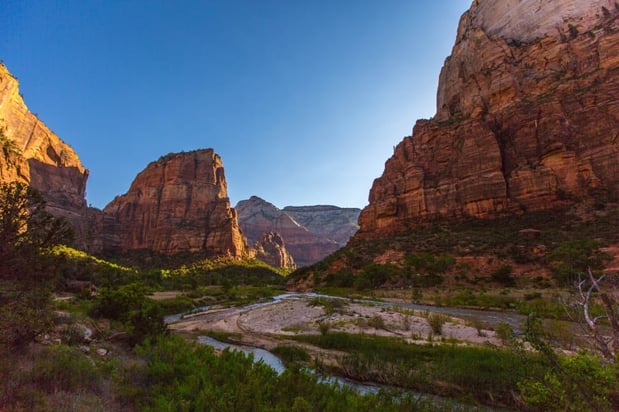
Humphreys Peak
Humphreys Peak is the highest in Arizona, reaching an elevation of 12,633 feet. It is located in the Coconino National Forest, near Flagstaff. The peak is a popular destination for hikers and climbers, with a well-defined trail leading to the summit. The hike to the summit is considered strenuous and is roughly 8 miles round trip with an elevation gain of over 3,000 feet. The summit offers spectacular views of the surrounding landscape, including the San Francisco Peaks, the Painted Desert, and the Grand Canyon. It is also a part of the Arizona Trail. traveling from Phoenix
Humphreys via Inner Basin
Humphreys via Inner Basin is a challenging hike that takes you through the Inner Basin of the San Francisco Peaks, located in Arizona. This hike is considered more strenuous than the standard Humphreys Peak hike, as it is longer and has a more significant elevation gain. The trailhead is located at the Snowbowl Ski Resort, and the hike is approximately 9 miles round trip with an elevation of around 4,500 feet. getting to Snowbowl Ski Resort The trail takes you through a beautiful alpine meadow with cascading streams and wildflowers in the summer. The track also offers excellent views of Humphreys Peak and the surrounding mountains. The hike is considered strenuous but offers more solitude and a different perspective of the mountain compared to the standard Humphreys Peak hike.
Mount Elden
Mount Elden is a 9,299-foot peak located in Flagstaff, Arizona. It is a popular destination for mountain bikers and hikers. It offers excellent views of the surrounding landscape, including the San Francisco Peaks, the Coconino National Forest, and Flagstaff. The peak is located within the Mount Elden Lookout Area, which is part of Coconino National Forest. Mount Elden trails Multiple trails lead to Mount Elden's summit, the most popular of which is the Elden Lookout Trail, a 3.7-mile round-trip hike with an elevation gain of 1,600 feet. It is important to note that the trails on Mount Elden are open all year, but they may be closed during the winter season due to snow. visiting Flagstaff trails It is always suggested to check the trail conditions before planning a hike, especially during the monsoon season (July-August) when the trail may be muddy or closed due to flash flood risk.
Arizona Shuttle is a transportation service that offers scheduled shuttle service to various destinations in Arizona. It provides transportation to and from major airports such as Phoenix Sky Harbor International Airport and Tucson International Airport, as well as other popular destinations such as Sedona, Flagstaff, and the Grand Canyon. Our services are known for their safe, reliable, and convenient transportation. They provide both shared and private shuttle service, with comfortable and clean vehicles equipped with air conditioning and Wi-Fi. They also offer door-to-door service to make your travel experience as convenient as possible.
Frequently Asked Questions
What's the elevation gain for the standard Humphreys Peak hike?
The standard Humphreys Peak hike has an elevation gain of over 3,000 feet.
How long is the Inner Basin route to Humphreys Peak compared to the standard route?
The Inner Basin route is approximately 9 miles round trip, while the standard route is roughly 8 miles round trip.
What are the best times of year to hike Mount Elden?
Mount Elden trails are open all year, but avoid winter due to potential snow closures and check conditions before hiking during monsoon season (July-August).
Can I get a shuttle service from Phoenix to Flagstaff for my hikes?
Yes, Airport Shuttle of Phoenix offers scheduled transportation services to various destinations in Arizona, including Flagstaff.
Top 3 Trekking Peaks of Arizona: Side-by-Side Comparison
Choosing between Arizona's three most rewarding summit treks comes down to how much time, elevation gain, and solitude you want. Here's a quick comparison to help you match the right peak to your fitness level and schedule:
| Peak | Elevation | Distance | Elevation Gain | Difficulty | Best For |
|---|---|---|---|---|---|
| Humphreys Peak (standard route) | 12,633 ft | ~8 miles round trip | 3,000+ ft | Strenuous | Bagging the state's highest point |
| Humphreys via Inner Basin | 12,633 ft summit | ~9 miles round trip | ~4,500 ft | Very strenuous | Solitude and alpine scenery |
| Mount Elden (Elden Lookout Trail) | 9,299 ft | 3.7 miles round trip | 1,600 ft | Moderate to strenuous | Half-day summit with city views |
Outdoors platforms like Komoot, which ranks dozens of Arizona summits for its community of more than 45 million outdoor enthusiasts, consistently place these Flagstaff-area peaks among the state's essential climbs — a reflection of how much varied terrain you can access from one base town.
Which Peak Should You Hike First?
If you want the state's highest point: Humphreys Peak
Nothing else in Arizona comes close. Standing on the summit of Humphreys Peak at 12,633 feet, you can often pick out the Grand Canyon's rim to the north and the Painted Desert stretching beyond the San Francisco Peaks. Because the standard route follows a well-defined trail out of Coconino National Forest, it's the most straightforward way to earn a genuinely high-altitude summit — but the elevation gain of over 3,000 feet at 9,000+ feet of starting altitude means you should plan an acclimatization day in Flagstaff first.
If you want fewer people on the trail: Humphreys via Inner Basin
The Inner Basin route begins at the Snowbowl Ski Resort trailhead and trades the standard route's switchbacks for a longer, steadier climb of roughly 4,500 feet over about 9 miles round trip. In summer, the basin itself is one of the prettiest places in northern Arizona — alpine meadows, wildflowers, and cascading streams beneath volcanic ridgelines. If your goal is scenery plus a summit, this is the version of Humphreys to pick.
If you're short on time: Mount Elden
Rising directly over the city of Flagstaff, Mount Elden's Elden Lookout Trail packs a 1,600-foot gain into just 3.7 miles round trip, making it the perfect morning or sunset outing. From the lookout you'll get sweeping views of the San Francisco Peaks, the Coconino National Forest, and Flagstaff itself — and you'll be back in town for lunch.
Getting to the Trailheads from Phoenix
All three peaks are clustered around Flagstaff, roughly two hours north of Phoenix via Interstate 17. The Humphreys Peak trailhead sits at the upper parking area of the Arizona Snowbowl, reached by turning off US Highway 180 onto Snowbowl Road and climbing several miles of paved forest road. Mount Elden's trailheads are even easier — they start at the edge of Flagstaff, so you can hike without ever leaving city limits.
If you'd rather not drive after a long flight or a strenuous hike, Airport Shuttle of Phoenix offers scheduled and door-to-door transportation statewide, including Phoenix Sky Harbor International Airport to Flagstaff, Sedona, and the Grand Canyon. Traveling with a group makes the ride up I-17 a chance to acclimatize and review trail maps instead of gripping the wheel through the curves of Oak Creek Canyon. Call (480) 710-3441 between 7 am and 5 pm MST to arrange a pickup, or find us at 4600 E Washington St Ste 300, Phoenix, AZ 85034.
Extending Your Trip: More Arizona Landscapes Worth the Detour
Flagstaff makes an ideal base camp, but some of Arizona's most iconic natural formations are within easy reach:
- Sedona's red rock country (about 45 minutes south via Highway 89A through Oak Creek Canyon): Short but spectacular trails like Cathedral Rock showcase the striking red sandstone formations that make this one of the most photographed landscapes in the world. Sunset here is a 10/10 experience.
- The Grand Canyon (about 80 minutes north on US 180 and AZ 64): Even a walk below the rim on Bright Angel Trail — with water available every 1.5 miles going down — changes how you see the state. Check current conditions, as portions of the North Rim have been affected by the 2025 fire.
- Phoenix-area peaks: On your way back to the Valley, Camelback Mountain offers a quick, steep urban summit near Scottsdale, and Lost Dutchman State Park — about 50 minutes outside Phoenix — delivers desert views from the Flatiron route. Devil's Bridge near Sedona is another short, rewarding natural landmark worth adding to any Arizona hiking bucket list.
Wherever you roam, follow Leave No Trace principles so these outdoor spaces stay wild for the next visitor.
Safety Tips for High-Altitude Trekking in Arizona
- Start early. Afternoon thunderstorms are common above the treeline on Humphreys Peak during monsoon season (July–August), and lightning is a real danger on exposed summits.
- Acclimatize. Sleeping a night in Flagstaff (7,000 feet) before attempting Humphreys dramatically reduces altitude sickness risk.
- Layer up. Summit temperatures on the San Francisco Peaks can be 30+ degrees colder than in Phoenix, even in summer.
- Check conditions. Mount Elden trails are open all year but can close for snow in winter, and trails may be muddy or shut down due to flash flood risk during the monsoon.
- Carry more water than you think you need. Arizona's dry air dehydrates hikers faster than most expect.
Frequently Asked Questions
Do I need a permit to hike Humphreys Peak?
No permit is required for a day hike on the standard Humphreys Peak trail or the Inner Basin route. Parking at the Snowbowl trailhead may require a posted day-use fee, so check signage when you arrive.
Is Mount Elden suitable for beginners?
The Elden Lookout Trail's 1,600 feet of gain over 3.7 miles is demanding but achievable for reasonably fit beginners, especially compared to the 3,000+ foot climbs on Humphreys Peak. Take your time and start in the morning.
When is the best season for trekking Arizona's peaks?
Late spring through early fall offers the most reliable conditions, with monsoon afternoons (July–August) best avoided on exposed summits. Winter brings snow closures to Mount Elden and serious avalanche and ice hazards on Humphreys.
How long does the Humphreys Peak hike take?
Most hikers complete the roughly 8-mile round trip standard route in 5 to 8 hours, depending on fitness and how much time they spend acclimatizing and enjoying the summit views.
Can I combine the Inner Basin route with a Sedona or Grand Canyon trip?
Yes. Flagstaff sits at the crossroads of I-17, I-40, US 180, and Highway 89A, making it easy to pair a peak trek with Sedona's red rock formations or a Grand Canyon rim visit over a long weekend.
Does Airport Shuttle of Phoenix offer private group transportation?
Yes. In addition to shared scheduled service, door-to-door private shuttle service is available across the state on your schedule, 24/7, with comfortable, air-conditioned vehicles — ideal for groups carrying hiking gear.
