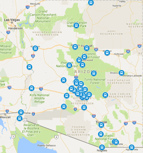
How far is Arizona City from Phoenix? About 60 miles and roughly an hour door to door in normal traffic, south on I-10 past Chandler and Casa Grande, then off at the Sunland Gin Road exit into the community. Arizona City is Pinal County's unincorporated retirement community: a quiet grid of patio homes around a golf course and a small commercial strip, drawing winter visitors and year-round retirees who want desert calm within reach of both Phoenix and Tucson. Snowbirds arriving for the season, visiting family, golfers on the community course, and new residents moving in all share one ground...
Recent Posts
How Far Is Village Of Oak Creek From Phoenix
October 30, 2026
How far is Village of Oak Creek from Phoenix? About 115 miles and roughly two hours door to door in normal traffic, north on I-17 to the Sedona country, then south on the Red Rock Scenic Byway into the village. Village of Oak Creek is Sedona's quieter southern neighbor: a resort and golf community wrapped around Bell Rock and Courthouse Butte, with red-rock trailheads, resort spas, and village shops drawing travelers who want the scenery without the uptown crowds. Resort guests, golfers, trailhead hikers, and red-rock wedding parties all share one ground leg: the scenic-byway ride from Sky...
How Far Is Tusayan From Phoenix
October 30, 2026
How far is Tusayan from Phoenix? About 220 miles and roughly three and three-quarter hours door to door in normal traffic, north on I-17 to Flagstaff, west on I-40, then north on AZ-64 through Valle to the gateway town at the park's doorstep. Tusayan exists for one reason: staging the Grand Canyon. Its hotels, restaurants, outfitter shops, and the Grand Canyon Airport runway serve rim visitors who sleep outside the park and enter at first light. Families on canyon itineraries, tour groups basing outside the gates, and hikers acclimating a night before a rim descent all share one ground leg:...
How Far Is Clarkdale From Phoenix
October 30, 2026
How far is Clarkdale from Phoenix? About 115 miles and roughly two hours door to door in normal traffic, north on I-17 to Camp Verde, then northwest on SR-260 into the Verde Valley. Clarkdale is the valley's company town turned arts community: a planned smelter town on the Verde River, now home to the canyon-railway depot, historic downtown shops, and Tuzigoot's hilltop pueblo ruins next door. Railway passengers, history travelers, river-country visitors, and Jerome overflow guests all share one ground leg: the grade-country ride from Sky Harbor to Clarkdale. It sits between the well-covered ...
How Far Is Dewey Humboldt From Phoenix
October 30, 2026
How far is Dewey-Humboldt from Phoenix? About 85 miles and roughly an hour and a half door to door in normal traffic, north on I-17 to Cordes Junction, then northwest on SR-69 through Mayer into the twin historic towns. Dewey-Humboldt pairs two old smelter and ranch settlements along the Agua Fria, a high-desert community of horse properties, historic main streets, and Prescott-country commuters. High-desert homeowners, horse-property visitors, history travelers working the mining towns, and Prescott-area workers staging south of the city all share one ground leg: the grade-country ride from...
How Far Is Black Canyon City From Phoenix
October 30, 2026
How far is Black Canyon City from Phoenix? About 50 miles and roughly an hour door to door in normal traffic, straight north on I-17 past New River into the Agua Fria river country. Black Canyon City is the Valley's first mountain stop: a former stagecoach and mining settlement turned highway town, famous for its pie stop and its position at the foot of the Sunset Point grades. Day-trippers staging for Prescott and Jerome, river-country homeowners, rock-shop and pie-stop visitors, and travelers breaking the high-country drive all share one ground leg: the short interstate ride from Sky Harbor...
How Far Is Heber Overgaard From Phoenix
October 30, 2026
How far is Heber-Overgaard from Phoenix? About 150 miles and roughly two and three-quarter hours door to door in normal traffic, northeast on AZ-87 up the Beeline Highway through Payson and into the Sitgreaves high country. Heber-Overgaard is the Valley's cabin country: twin mountain towns merged along AZ-260, ringed by ponderosa forest, with summer cabins, tall-pine RV parks, and fishing lakes drawing the same families back for decades. Cabin owners heading up for the weekend, fishing and hunting parties, summer-event travelers, and retirees splitting time between the mountains and the...
How Far Is Holbrook From Phoenix
October 30, 2026
How far is Holbrook from Phoenix? About 215 miles and roughly three and a half hours door to door in normal traffic, northeast on AZ-87 through Payson and the rim country, then east past Winslow and west on I-40 into Holbrook. Holbrook anchors the high desert of Navajo County on historic Route 66, the county seat and gateway to the Petrified Forest, with its famous concrete-tipi motel row and dinosaur statues marking the old highway. Route 66 travelers, Petrified Forest visitors, court and county-business travelers, and families with high-desert roots all share one ground leg: the long...
How Far Is Grand Canyon From Phoenix
October 30, 2026
How far is the Grand Canyon from Phoenix? About 230 miles and roughly four hours door to door in normal traffic, north on I-17 to Flagstaff, west on I-40, then north on AZ-64 through Tusayan to the South Rim entrance. The canyon's South Rim is Arizona's most-visited ground: Mather Point sunrises, the Bright Angel and South Kaibab trailheads, the historic El Tovar and Bright Angel lodges, and the Desert View drive draw travelers from every continent. First-time visitors, rim-trail hikers, tour groups, and families on once-in-a-lifetime trips all share one ground leg: the long high-country ride...
How Far Is Thatcher From Phoenix
October 30, 2026
How far is Thatcher from Phoenix? About 170 miles and roughly three hours door to door in normal traffic, east on US-60 through the Superstition foothills and Globe, then southeast on US-70 down the Gila Valley into Thatcher. Thatcher anchors the upper Gila Valley beside Safford, a college and farming town built on irrigated cotton and copper-country wages, home to Eastern Arizona College and the valley's historic Mormon pioneer settlements. Students and visiting families, farm and mine workers on rotation, and college-event travelers all share one ground leg: the mountain-highway ride from...
How Far Is Sun City West From Phoenix
October 30, 2026
How far is Sun City West from Phoenix? About 30 miles and roughly 40 minutes door to door from Sky Harbor in normal traffic, northwest out of the airport corridor to I-17, north past the Loop 101 stack, then west on Bell Road into the heart of the retirement community. Sun City West is the younger sibling of the original Sun City: a master-planned active-adult community of golf courses, recreation centers, and gated subdivisions wrapped around the Banner Boswell medical corridor. Winter visitors renting for the season, grandparents flying in to see family, golfers on desert-course rotations,...
How Far Is Prescott Valley From Phoenix
October 30, 2026
How far is Prescott Valley from Phoenix? About 85 miles and roughly an hour and a half door to door from Sky Harbor in normal traffic, north on I-17 up the Black Canyon grade, over the Sunset Point climb, then east on AZ-69 into the high-desert valley. Prescott Valley has grown from a ranching outpost into one of the fastest-growing towns in northern Arizona, a spread of subdivisions, event-center crowds, and retail corridors set between Prescott and Dewey at a mile of elevation. Commuters with Sky Harbor flights, families in the Granville and Viewpoint neighborhoods, event-goers at the...
How Far Is Vail From Phoenix
October 30, 2026
How far is Vail from Phoenix? About 140 miles and roughly two hours and ten minutes door to door from Sky Harbor in normal traffic, southeast on I-10 past Casa Grande and Picacho Peak, past the Marana and Tucson interchanges, then into the Rincon foothills community. Vail is the fast-growing southeastern suburb: master-planned neighborhoods filling the desert between the interstate and the Rincon Mountains, Colossal Cave drawing cavern visitors, Saguaro East trailheads staging hikers, and school-district families commuting across the whole metro. New-home families flying out for the holidays,...
How Far Is Oracle From Phoenix
October 30, 2026
How far is Oracle from Phoenix? About 100 miles and roughly an hour and fifty minutes door to door from Sky Harbor in normal traffic, southeast on US-60 through Apache Junction and Gold Canyon, south on AZ-79 through Florence, then east on AZ-77 through Oracle Junction into the high-desert town. Oracle is a quiet foothill community tucked against the northern Catalinas: the Biosphere 2 research campus drawing science visitors, Arizona Trail hikers staging resupplies, winter renters in the high-desert subdivisions, and ranch families working the surrounding grasslands. Science-center visitors...
How Far Is Safford From Phoenix
October 30, 2026
How far is Safford from Phoenix? About 165 miles and roughly two and three-quarter hours door to door from Sky Harbor in normal traffic, east on US-60 through Apache Junction and Superior, over the Queen Creek grade past Miami and Globe, then southeast on US-70 through the farm towns into Safford. Safford anchors the Gila Valley: cotton and chile fields, the Mount Graham foothills rising behind town, Eastern Arizona College drawing students and parents, and the big mine operations running shifts around the clock. College families on move-in weekends, miners on crew rotations, farm families...
How Far Is Tubac From Phoenix
October 30, 2026
How far is Tubac from Phoenix? About 200 miles and roughly three hours door to door from Sky Harbor in normal traffic, southeast on I-10 past Casa Grande and Picacho Peak, then south on I-19 through Green Valley into the Santa Cruz valley gallery town. Tubac is Arizona's artists' colony: adobe studios and galleries lining the old presidio streets, the Tumacacori mission park minutes south, snowbird casitas filling for the winter, and festival weekends that double the little town overnight. Gallery-hoppers on day escapes, winter renters settling into casitas, festival-goers timing the art...
How Far Is Benson From Phoenix
October 30, 2026
How far is Benson from Phoenix? About 150 miles and roughly two and a third hours door to door from Sky Harbor in normal traffic, southeast on I-10 past Casa Grande and Picacho Peak, through Texas Canyon, then into the San Pedro valley. Benson is a railroad and ranch town turned sky-island gateway: Kartchner Caverns staging, Butterfield stage history, RV parks along the San Pedro River, and mine and rail workers on rotation. Cavern visitors timing tour slots, RVers wintering along the river parks, history buffs working the stage routes, and workers on the mine and rail schedules all share one...
How Far Is Jerome From Phoenix
October 30, 2026
How far is Jerome from Phoenix? About 115 miles and roughly two hours door to door from Sky Harbor in normal traffic, north on I-17 over the grades, west through Cottonwood on AZ-260, then up the AZ-89A switchbacks into the hillside town. Jerome is Arizona's famous mountainside mile-high town: a former copper camp turned gallery and wine destination, its hotels and shops clinging to Cleopatra Hill above the Verde Valley. Gallery-hoppers on weekend stays, wedding parties booking the hillside hotels, wine-trail visitors working the Cottonwood tasting rooms, and history buffs touring the mine...
How Far Is Winslow From Phoenix
October 30, 2026
How far is Winslow from Phoenix? About 190 miles and roughly three hours door to door from Sky Harbor in normal traffic, northeast on the Beeline Highway through Fountain Hills and Payson, over the Mogollon Rim country, then across the high plains into Winslow. Winslow is classic Route 66 Arizona: the standing-on-the-corner park, the La Posada hotel, rail yards that still work around the clock, and the Meteor Crater turnoff drawing road-trippers from everywhere. Route 66 tourists staging a night, rail and logistics workers on rotation, families visiting across Navajo County, and crater-bound...
How Far Is Chino Valley From Phoenix
October 30, 2026
How far is Chino Valley from Phoenix? About 95 miles and roughly an hour and three-quarters door to door from Sky Harbor in normal traffic, north on I-17 over the grades, east on AZ-69 through Prescott Valley, then north on AZ-89 into the wide ranch valley. Chino Valley is working ranch country turned high-desert suburb: hay fields and horse properties along the old highway, new subdivisions filling the flats, and a main-street corridor serving the whole upper valley. Ranch families with Sky Harbor flights, horse owners hauling show schedules, workers commuting to the Prescott-area employment...