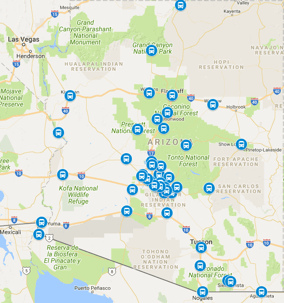
How far is Quartzsite from Phoenix? About 130 miles and roughly two hours door to door in normal traffic, straight west on I-10 past Tonopah and the Harquahala Plain into the far western desert. Quartzsite is a small town with an outsized winter reputation: every January and February the gem, mineral, and RV shows turn the quiet highway stop into one of the busiest snowbird gathering points in the Southwest. Winter visitors flying into Sky Harbor, vendors hauling show inventory, RVers staging the season, and desert travelers working the far-west corridor all share one ground leg: the long...
Recent Posts
How Far Is Laveen From Phoenix
October 30, 2026
How far is Laveen from Phoenix? About 15 miles and roughly 20 to 30 minutes door to door from Sky Harbor in normal traffic, southwest into the South Phoenix village set against the slopes of South Mountain. Laveen has grown from farmland into one of the fastest-growing residential areas in the city, a grid of new subdivisions, Baseline Road shopping corridors, and rural-edge ranchettes all sitting south of the Salt River. Commuters with Sky Harbor flights, families in the new-build subdivisions, visitors to the South Mountain trailheads, and travelers staging near the Gila River community...
How Far Is Eloy From Phoenix
October 30, 2026
How far is Eloy from Phoenix? About 65 miles and roughly one hour door to door from Sky Harbor in normal traffic, straight south on I-10 past the outlet-mall interchanges and the Picacho Peak landmark. Eloy sits at the midpoint of the Phoenix-Tucson corridor, a small farm and rail city turned halfway stop with outlet shopping, skydiving operations, and a growing logistics footprint. Travelers visiting family in Pinal County, shoppers working the outlet corridors, workers at the distribution centers, and Tucson-bound visitors staging a stop all share one ground leg: the straight interstate run...
How Far Is Douglas From Phoenix
October 30, 2026
How far is Douglas from Phoenix? About 230 miles and roughly three and three-quarter hours door to door in normal traffic, southeast on I-10 to Benson, then south on AZ-80 through Tombstone and Bisbee into the Sulphur Springs Valley. Douglas anchors the southeastern corner of the state at the international port area, the historic smelter and railroad city of Cochise County, and its airport run is among the longest booked rides in Arizona. Families with roots on both sides of the line, history travelers working the mining-town triangle, birders bound for the valley preserves, and port-area...
How Far Is Marana From Phoenix
October 30, 2026
How far is Marana from Phoenix? About 90 miles and roughly an hour and a half door to door in normal traffic, southeast on I-10 past Casa Grande and Picacho Peak straight into the northwest Tucson metro. Marana has grown from a farm town into one of the fastest-growing suburbs in the state, spread along both sides of the interstate from Continental Ranch and Gladden Farms to the resort foothills in the Tortolita Mountains. Commuters with Sky Harbor flights, families visiting the Tortolita and Saguaro-area subdivisions, golfers on the foothill courses, and travelers staging near the Pinal...
How Far Is Nogales From Phoenix
October 30, 2026
How far is Nogales from Phoenix? About 180 miles and roughly two and three-quarter hours door to door in normal traffic, southeast on I-10 past Casa Grande and Picacho Peak, then south on I-19 through Green Valley into the Santa Cruz valley. Nogales anchors the far southern end of the I-19 corridor at the international port area, the county seat of Santa Cruz County, and its airport run is one of the longest regularly booked rides in the state. Shoppers visiting the historic downtown, families with relatives on both sides of the line, birders working the valley preserves, and business...
Phoenix to Prescott Whiskey Row Shuttle Guide
October 29, 2026
Phoenix to Prescott is the Valley's cool-air escape: north on I-17 to the high desert, west on SR 69 into mile-high pines and granite dells, ending on a courthouse square ringed by the most famous saloon block in Arizona. The trip covers about 100 miles and roughly an hour and three quarters door to door in normal traffic, ending at Whiskey Row, the Courthouse Square's summer concerts and craft markets, and a downtown of bookstores, galleries, and tasting rooms. Watson Lake's granite dells paddle and boulder a few minutes out; Thumb Butte anchors the trail system above town; Sharlot Hall...
Phoenix to Flagstaff Route 66 Shuttle Guide
October 29, 2026
Phoenix to Flagstaff is Arizona's climate-change run: up I-17 out of the desert, through the Verde Valley and the ponderosa belt, into a mountain town near seven thousand feet where Route 66 neon, a university campus, and an observatory share the same few square miles. Read more about Sedona trip cost breakdown. The trip covers about 145 miles and roughly two hours and fifteen minutes door to door in normal traffic, ending in a downtown of brick storefronts, brewery patios, and the historic rail depot with the San Francisco Peaks on the skyline. Lowell Observatory, where Pluto was discovered,...
Phoenix to Jerome Hillside Town Shuttle Guide
October 29, 2026
Phoenix to Jerome is the Verde Valley's vertical mile: a former copper camp of five thousand people turned hillside town of a few hundred, clinging to Cleopatra Hill a thousand feet above the valley floor with views across the valley to the Sedona red rocks. The trip covers about 115 miles and roughly two and a quarter hours door to door in normal traffic, ending on streets so steep that staircases substitute for sidewalks between levels. Jerome State Historic Park and the Douglas Mansion tell the mining story, the Gold King Mine ghost town down the hill runs saws and engines for visitors,...
Phoenix to Grand Canyon South Rim Shuttle Guide
October 29, 2026
Phoenix to Grand Canyon South Rim is Arizona's signature bucket-list run: north on I-17 through the Verde Valley and Flagstaff, west on US-180, then north on AZ-64 to the Tusayan gateway and the park's South Entrance. The trip covers about 230 miles and roughly three hours and forty-five minutes door to door in normal traffic, ending at Mather Point, Bright Angel, Desert View, and a rim trail system that works for sunrise chasers, family reunions, tour groups, and cautious rim walkers alike. Maswik Lodge, Yavapai Lodge, and the Tusayan hotel strip anchor overnights; the Canyon's free park...
Phoenix to Desert Botanical Garden Shuttle Guide
October 29, 2026
Phoenix to Desert Botanical Garden is the city's easiest culture run: east from Sky Harbor about ten miles into Papago Park, roughly fifteen to twenty minutes door to door, ending at one hundred forty acres of themed trails, towering saguaros, and tens of thousands of desert plants. The garden anchors snowbird itineraries, school field trips, photography mornings, and wedding weekends, with the Phoenix Zoo next door, Hole-in-the-Rock a short walk away, and Tempe Town Lake dinners closing the evening. Seasonal draws rotate through the year: spring wildflower loops, summer flashlight nights,...
Phoenix to Sedona Red Rocks Shuttle Guide
October 29, 2026
Phoenix to Sedona is the Valley's signature red rock run: north on I-17 out of the city, climbing past Sunset Point and down into the Verde Valley, then onto the scenic byways that thread between the formations into town. The trip covers about 118 miles and roughly two hours door to door in normal traffic, ending among Cathedral Rock, Bell Rock, Courthouse Butte, and a trail system that draws hikers, photographers, wellness retreaters, and wedding parties from everywhere. Read more about Sedona trip cost breakdown. Slide Rock State Park, Uptown shops and galleries, Tlaquepaque arts village,...
Phoenix to Payson Mogollon Rim Shuttle Guide
October 29, 2026
Phoenix to Payson and the Mogollon Rim is the Valley's signature escape-the-heat run: northeast up AZ-87, the Beeline Highway, climbing out of the desert into ponderosa country in about an hour and a half in normal traffic. Payson sits at the doorstep of the Rim, the great pine-topped escarpment that anchors hiking weekends, fishing trips, fall-color drives, and summer cool-off escapes for parties staying anywhere in the Valley. Main-street shops, lake turnoffs, and Rim trailheads share one mountain town off the highway. It extends the well-covered Payson airport shuttle guide corridor upward...
Phoenix to Bartlett Lake Shuttle Guide
October 29, 2026
Phoenix to Bartlett Lake is the northeast Valley's signature water run: north out of the city past Cave Creek, then onward on winding desert roads to the reservoir tucked into the Tonto National Forest foothills. The lake centers on boating, fishing, kayaking, and shoreline picnics, with a marina, boat ramps, and picnic coves spread along miles of desert shoreline, and it anchors fishing weekends, family lake days, and summer cool-off trips for parties staying anywhere in the Valley. Read more about Lake Havasu City shuttle guide. Launch ramps, the marina store, and the developed picnic areas...
Lost Dutchman Superstition Shuttle Guide
October 29, 2026
Phoenix to Lost Dutchman State Park is the East Valley's signature day-hike run: out US-60 to Apache Junction, then northeast on AZ-88, the Apache Trail, to the park entrance at the foot of the Superstition Mountains. The park is the trailhead side of the Lost Dutchman legend, with saguaro-studded loops in front of sheer cliff faces, rugged climbs into the mountain interior, and some of the most photographed desert scenery in the state. It anchors hiking weekends, treasure-legend sightseeing, and winter-visitor day trips for parties staying anywhere in the Valley. Campground loops, picnic...
Phoenix to Lake Pleasant Shuttle Guide
October 29, 2026
Phoenix to Lake Pleasant is the northwest Valley's home-water run: about 30 miles and roughly 40 to 55 minutes door to door in normal traffic, north on I-17 then west on the Loop 303 corridor to the reservoir cupped by desert hills past the far edge of Peoria. Read more about Glendale from Phoenix guide. The lake is the Valley's big-water boating reservoir, with two full marinas, launch ramps, shoreline campgrounds, and a no-wake world of pontoons, fishing boats, kayaks, and sunset cruises, and it anchors summer lake weekends, fishing mornings, and group pontoon days for parties staying...
Phoenix to Picacho Peak Shuttle Guide
October 29, 2026
Phoenix to Picacho Peak State Park is the I-10 corridor's signature roadside summit: about 65 miles and roughly 70 to 80 minutes door to door in normal traffic, south on the interstate past Eloy to the unmistakable steep-sided peak rising straight out of the desert floor a few minutes beyond. The park centers on a rugged 3,000-plus-foot summit with cabled trail sections, a campground, and spring wildflower displays that draw photographers from across the state, and it anchors hiking weekends, wildflower day trips, and road-trippers breaking the Phoenix-to-Tucson drive for parties staying...
Phoenix to Casa Grande Ruins Shuttle Guide
October 29, 2026
Phoenix to Casa Grande Ruins National Monument is the Valley's closest ancient-history run: about 55 miles and roughly 65 to 80 minutes door to door in normal traffic, south on I-10 past Eloy toward Casa Grande, then east through farmland into Coolidge where the great house has stood for more than six centuries. Read more about Phoenix to Tucson drive. The monument protects a four-story earthen great house and its surrounding compound, built by the ancestral desert farming people of the Gila Valley, and it anchors school field trips, archaeology-curious weekends, and winter-visitor day trips...
Phoenix to Biosphere 2 Shuttle Guide
October 29, 2026
Phoenix to Biosphere 2 is the Oracle-country science run: about 110 miles and roughly an hour and fifty minutes door to door in normal traffic, south on I-10 past Casa Grande and Eloy, then north on AZ-77 through Oracle Junction to the glass-enclosed research campus in the foothills. Read more about Phoenix to Tucson distance. The facility is the largest living laboratory of its kind, a sealed world of rainforest, ocean, and desert biomes run by the University of Arizona, and it anchors school field trips, science-curious weekends, and conference add-ons for visitors staying in the Valley....
Phoenix to Boyce Thompson Arboretum Guide
October 29, 2026
Phoenix to Boyce Thompson Arboretum is the east-Valley garden run: about 60 miles and roughly an hour door to door in normal traffic, east on US-60 past Gold Canyon and Florence Junction to the Queen Creek canyon country, with the gardens sitting three miles west of Superior beneath Picketpost Mountain. The arboretum spreads across nearly 400 acres along Queen Creek, assembling desert plants from around the world beside native cottonwood groves, and it anchors spring wildflower weekends for photographers, birders, school groups, and families pairing the trails with a Superior lunch. Shaded...