
Arizona is known for its stunning natural beauty, from Sedona to the majestic Grand Canyon. But did you know that Arizona is also rich in history? The state is home to numerous national parks that offer visitors a chance to learn about the past and the people and events that shaped Arizona's unique cultural heritage. In this blog, we'll look at some of Arizona's top national parks to visit in April and how Arizona Shuttle can help you get there. Phoenix to Grand Canyon shuttle
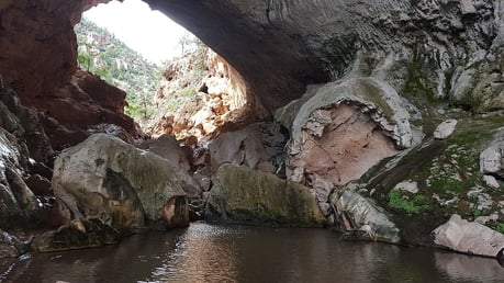
Petrified Forest National Park
The Petrified Forest National Park is a unique and fascinating destination in northeastern Arizona. The park is home to the world's largest and most colorful concentrations of petrified wood, ancient petroglyphs, historic structures, and vast badlands that provide insight into the area's geologic history. Petrified Forest access Petrified Forest access Visitors can drive through the park's 28-mile-long road or hike one of the many trails, including the Painted Desert Rim Trail, which offers stunning views of the park's colorful badlands.
Tonto National Monument
In central Arizona, Tonto National Monument is home to two well-preserved cliff dwellings inhabited by the Salado people between the 13th and 15th centuries. Tonto National Monument visit Tourists can take a guided tour of the dwellings, learn about the Salado culture, and hike the short trail that leads to the dwellings and provides panoramic views of the surrounding desert landscape. Tonto National Monument visit
Montezuma Castle National Monument
It is located in central Arizona and is a well-preserved cliff dwelling built by the Sinagua people in the 12th century. The five-story place is carved into a limestone cliff and offers a glimpse into the daily lives of the Sinagua people. Guests can take a self-guided tour of the dwelling and explore the surrounding museum and nature trails.
Grand Canyon National Park
Every visit to Arizona is complete with a Grand Canyon National Park trip. Located in northern Arizona, the Grand Canyon is one of the world's most awe-inspiring natural wonders, offering visitors breathtaking views of the canyon's vast expanse and stunning rock formations. Guests can tour the park, hike one of the many trails, or enjoy the stunning vistas from the rim. Grand Canyon travel guide Grand Canyon transport options
How Arizona Shuttle Can Help
Getting to Arizona's national parks can be challenging, especially if you need to become familiar with the area. That's where Arizona Shuttle comes in. Our shuttle service provides comfortable and convenient transportation to all of Arizona's top destinations, including its national parks. With Arizona Shuttle, you can sit back and relax as we take you to your destination, leaving you free to enjoy the sights and sounds of Arizona's rich history.
In conclusion, Arizona's national parks allow visitors to explore the state's rich history and natural beauty. Whether interested in ancient civilizations, geology or want to take in the stunning vistas, Arizona's national parks have something for everyone. And with Arizona Shuttle, getting to these destinations has always been challenging. So, what are you waiting for? Plan your trip today and discover Arizona's fascinating past!
Frequently Asked Questions
What are some good trails to hike in Petrified Forest National Park?
You can hike the Painted Desert Rim Trail for stunning views of the colorful badlands.
How long does a guided tour at Tonto National Monument usually take?
Guided tours typically last about 1-2 hours, offering insights into Salado culture and history.
What makes Montezuma Castle National Monument unique?
It features a five-story cliff dwelling carved into a limestone cliff by the Sinagua people in the 12th century.
Can I see the Grand Canyon rim from my hotel room?
While some hotels offer canyon views, it's best to visit the park for breathtaking vistas and trails.
More Arizona National Park Sites Worth Adding to Your Itinerary
Arizona is often called the "granddaddy of national park states" for good reason — beyond the four sites covered above, the National Park Service manages a long list of additional monuments and parks across the state. If you have extra time, these are some of the most rewarding additions to any trip focused on visiting Arizona's national parks.
Saguaro National Park (Tucson)
Saguaro National Park protects the iconic saguaro cactus forests of the Sonoran Desert in two districts that ring the city of Tucson. The Rincon Mountain District sits east of the city along Old Spanish Trail, while the Tucson Mountain District lies to the west via Speedway Boulevard and Gates Pass Road. Both districts offer scenic loop drives — the Cactus Forest Drive in the east and the Bajada Loop Drive in the west — plus hiking trails ranging from short nature walks to all-day desert treks. Southern Arizona runs noticeably warmer than the northern parks, so early morning visits are the smartest way to explore this one.
Canyon de Chelly National Monument (Chinle)
Canyon de Chelly, on the Navajo Nation in northeastern Arizona near the town of Chinle, is one of the longest continuously inhabited landscapes in North America. Unlike most park sites, the canyon floor is accessible only with an authorized Navajo guide, but the two rim drives — North Rim Drive and South Rim Drive — are open to all visitors and include overlooks such as Spider Rock, a towering sandstone spire. The monument pairs naturally with a Petrified Forest itinerary since both sit in the northeastern corner of the state.
Flagstaff Area Monuments: Walnut Canyon, Sunset Crater, and Wupatki
Flagstaff makes an excellent base for three smaller sites. Walnut Canyon National Monument, just east of the city off I-40, protects cliff dwellings tucked into a limestone canyon. Sunset Crater Volcano National Monument, reached via US-89 north of Flagstaff, preserves the cinder cone and lava flows from the volcano's eruption around the year 1085. Continuing on the same loop road brings you to Wupatki National Monument, home of a large ancestral Puebloan community. The loop connecting Sunset Crater and Wupatki is one of the most convenient half-day drives in northern Arizona.
Organ Pipe Cactus National Monument (Ajo)
In far southern Arizona along State Route 85 near the border town of Ajo, Organ Pipe Cactus National Monument protects a stretch of Sonoran Desert where the organ pipe cactus — rare in the United States — grows in abundance. It is the most remote of the sites on this list, so plan a full day of driving from Phoenix or Tucson, and carry plenty of water.
Arizona National Park Sites at a Glance
| Park Site | Region | Nearest City | Main Route | Signature Feature |
|---|---|---|---|---|
| Grand Canyon National Park | Northern Arizona | Tusayan / Williams | AZ-64 to South Rim | Canyon vistas from the rim |
| Petrified Forest National Park | Northeastern Arizona | Holbrook | I-40 / Historic Route 66 | Petrified wood and Painted Desert badlands |
| Saguaro National Park | Southern Arizona | Tucson | Old Spanish Trail / Gates Pass Road | Saguaro cactus forests |
| Canyon de Chelly National Monument | Northeastern Arizona | Chinle | US-191 | Spider Rock and Navajo-guided canyon tours |
| Tonto National Monument | Central Arizona | Roosevelt / Payson | AZ-188 | Salado cliff dwellings |
| Montezuma Castle National Monument | Verde Valley | Camp Verde | I-17, Exit 289 | Five-story Sinagua cliff dwelling |
| Walnut Canyon / Sunset Crater / Wupatki | Flagstaff area | Flagstaff | I-40 and US-89 | Cliff dwellings, volcano, and pueblo ruins |
When to Visit Arizona's National Parks
Timing matters more in Arizona than in most states because elevations vary enormously. The Grand Canyon's South Rim sits at roughly 7,000 feet, where spring can still bring snow, while Saguaro and Organ Pipe in the south can be dangerously hot by late spring and summer. As a general rule, the parks covered in this guide are at their best in spring and fall, when daytime temperatures are comfortable across most of the state. Summer remains popular at the Grand Canyon thanks to its high elevation and cooler rim temperatures, while the desert monuments are best enjoyed early in the morning. Winter visitors should check road conditions on routes like AZ-64 and US-89, as northern Arizona does receive snow. Always confirm current hours, road status, and tour availability directly with the National Park Service before you set out.
Getting Around: Key Highways for Arizona Park Trips
Most Arizona national park itineraries revolve around a handful of corridors. I-17 is the main artery from Phoenix to Flagstaff and continues toward the Verde Valley monuments like Montezuma Castle. From Flagstaff or Williams, AZ-64 leads to Grand Canyon's South Entrance. I-40 crosses the state past Flagstaff and Holbrook, putting the Petrified Forest's northern entrance just off the interstate, with the park road running south toward Highway 180. Central Arizona travelers heading to Tonto National Monument typically take AZ-87 (the Beeline Highway) toward Payson and connect via AZ-188 along Roosevelt Lake. In the south, I-10 serves Tucson for Saguaro, and AZ-85 runs south from the Phoenix area toward Organ Pipe Cactus National Monument. If you would rather leave the driving to someone else, Arizona Shuttle offers ground transportation connecting Phoenix with popular destinations such as the Grand Canyon and Flagstaff, which can simplify a trip built around these routes.
Practical Tips for a Smooth Park Visit
- Carry more water than you think you need — the desert climate is deceptively dry even on cool days.
- Check the National Park Service site for each park you plan to visit for entrance requirements, timed tours, and seasonal closures.
- Start early: popular overlooks and trailheads at the Grand Canyon and Saguaro fill up quickly on busy days.
- Elevations range from desert floor to mountain rim, so pack layers no matter the season.
- Cell service is limited at sites like Canyon de Chelly and Tonto National Monument — download maps in advance.
Frequently Asked Questions
What is the most visited national park site in Arizona?
Grand Canyon National Park is by far Arizona's most visited national park and one of the most visited in the country. Expect the South Rim, reached via AZ-64 from Williams or Tusayan, to be busiest during summer and holiday periods.
Can I see multiple Arizona national parks in one trip?
Yes. A classic loop uses I-17 to Flagstaff, I-40 east to the Petrified Forest, and AZ-64 back to the Grand Canyon. Central Arizona sites like Montezuma Castle and Tonto National Monument also combine well on a Phoenix-based itinerary.
Do I need a guide at Canyon de Chelly?
Yes, travel below the rim requires an authorized Navajo guide. However, both rim drives with their overlooks, including Spider Rock, are open to all visitors without a guide.
Is April a good month to visit Arizona's national parks?
Spring is one of the best times overall. The desert parks are mild and often blooming, and the Grand Canyon's South Rim is usually accessible, though early spring snow is still possible at higher elevations.
Which Arizona parks are best for visitors with limited mobility?
Montezuma Castle's main viewing area and the Grand Canyon's rim trail sections are popular, accessible ways to experience these sites. Check each park's accessibility page on the National Park Service website for the latest details before your visit.
How far in advance should I plan a Grand Canyon trip from Phoenix?
The drive from Phoenix to the South Rim generally takes several hours via I-17 and AZ-64. Book lodging in Tusayan, Williams, or Grand Canyon Village well ahead of peak season, and consider a shuttle service if you prefer not to drive the route yourself.
Are there national park sites outside the famous ones worth visiting?
Absolutely. Saguaro National Park, Canyon de Chelly, Organ Pipe Cactus, and the Flagstaff-area monuments of Walnut Canyon, Sunset Crater, and Wupatki all offer memorable experiences with smaller crowds than the Grand Canyon.
